Tenny Creek
1934
2005
Description:
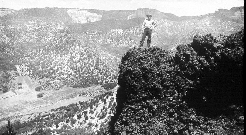
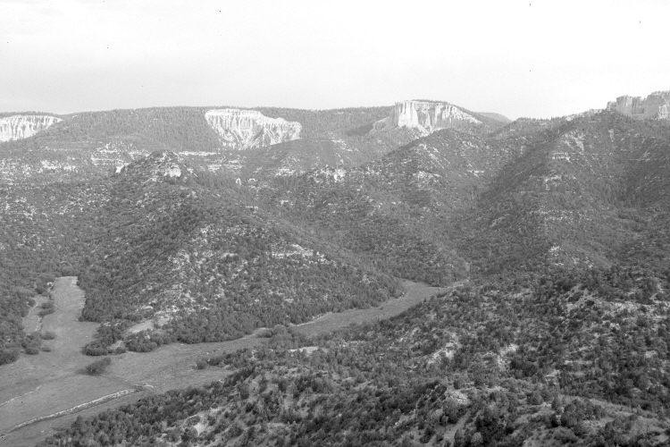
Plate 897X. Tenny Creek 1934 – 2005 Viewed northwest across Tenny Creek to the Pink Cliffs at the southern end of the Paunsaugunt Plateau. Conifers now block the original camera station, so the retake was made from the nearest open area, which is at a slightly higher elevation. Most of the cinder formation seen in the initial image, however, has been removed by erosion. The meadows along Tenny Creek are privately owned and the gullies have been plugged. All woody species have increased. This includes pinyon, juniper, oakbrush, Utah serviceberry, true mountain mahogany, bitterbrush, shinny-leaf manzanita, spruce, white fir, Doulgas fir, and ponderosa pine. Forest fuels have increased accordingly setting the stage for a high-intensity crown fire.
Photo Information:
Original photograph taken by H.E. Gregory (No. 731) in 1934; retake by Charles E. Kay on June 22, 2005 - - Photo No. 5465-8A. Original photograph held by the the U.S. Geological Survey Photographic Library, Denver, CO.
Vegetative Community:
Conifer, Pinyon, Juniper, Oakbrush, Mountain Brush
Location:
South West: Section 25, Range 4 ½ West, Township 39 South; UTM 383300 E, 4138100 N; elevation 8,000 ft.