Taylor Creek
1906
2007
Description:
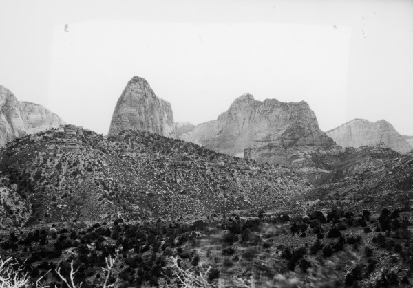
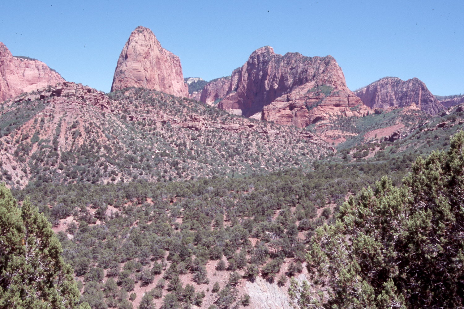
Plate 1469X. Taylor Creek 1906 – 2007 Plates 1466x to 1469x present a panorama of the Taylor Creek drainage in the Kolob Canyons section of Zion National Park. Plate 1469x is viewed east up the South Fork of Taylor Creek. From left to right on the skyline are Tucupit Point, Paria Point (7,802 ft.), Beatty Point (7,780 ft.), and Nagnut Mesa (7,785 ft.). Pinyon and juniper have increased as have mountain brush species, including gambel oak, Utah serviceberry, turbinella oak, and birchleaf mountain mahogany.
Photo Information:
Original photograph taken by Lee (No. 236) in 1906; retake by Charles E. Kay on June 25, 2007 - - Photo No. 5821-28. Original photograph held by the U.S. Geological Survey Photographic Library, Denver, CO.
Vegetative Community:
Pinyon, Juniper, Mountain Brush
Location:
South West: Section 28, Range 12 West, Township 38 South; UTM 305189 E, 4148214 N; elevation 5,808 ft.