Tantalus Flat
1965

2002
Description:
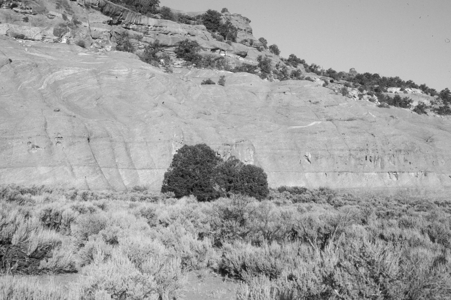
Plate 4X. Tantalus Flat 1965-2002 Viewed northwest across Tantalus Flat on the lower eastside of Boulder Mountain. Note the helicopter in the original spraying herbicide to kill the woody plants. Despite that treatment, however, big sagebrush is more common in the retake. The three pinyon (Pinus edulis) at the base of the cliff have increased in height. The large shrub to the left of the three pines in the original is a Utah serviceberry (Amelanchier utahensis), which may have been damaged by the herbicide application. Many of the surrounding sagebrush are more than six feet tall and also partially block the serviceberry plant view. Grasses appear to have declined, which again may be due to the extended drought, as well as competition from the sagebrush. The site was heavily grazed by cattle in 2002.
Photo Information:
Original photograph by the U.S. Forest Service (unnumbered) in May 1965; retake by Charles E. Kay on July 6, 2002 - - Photo No. 4953-6. Original photo held by Southern Utah University Archives and Special Collections, Cedar City, UT.
Vegetative Community:
Pinyon, Mountain Brush
Location:
South West: Section 2, Range 6 East, Township 31 South; UTM 481300E, 4220800N; elevation 6,520 ft.