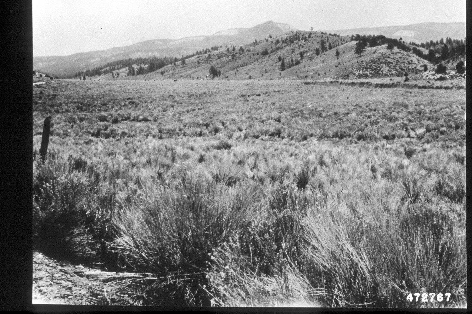
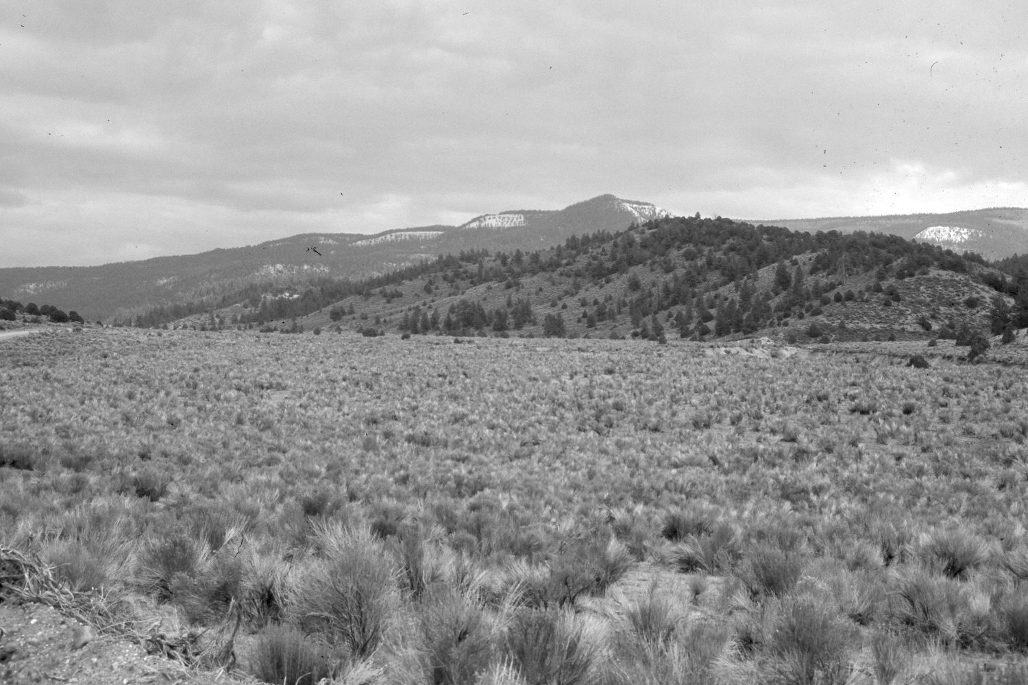
Sweetwater Creek
1951
2002
Description:
Plate 101X. Sweetwater Creek 1951-2002 Viewed southeast up Sweetwater Creek with Barney Top in the distance (photo right edge). The photopoint is on the Escalante to Widtsoe Road (FH 17), which is visible along the left edge of the images. The original was taken to show how rubber rabbitbrush had invaded what was once a cultivated field. After the first photograph, the area was root-plowed and reseeded with crested wheatgrass (Agropyron cristatum). Crested wheatgrass is still present but the site has been reinvaded by rubber rabbitbrush. The area was heavily grazed by cattle in 2002. Note the increase in pinyon, juniper, and ponderosa pine on the near hillside. Sweetwater Creek is in the gully on the right of the images - - see Plates 102X and 103X.
Photo Information:
U.S. Forest Service photograph 472767 taken by T.A. Phillips in May 1951; retake by Charles E. Kay on August 6, 2002 - - Photo No. 5010-32. Original photograph held by the Utah Historical Society, Reed W. Bailey Collection, Salt Lake City, UT.
Vegetative Community:
Pinyon, Juniper, Riparian
Location:
South West: Section 24, Range 2 West, Township 34 South; UTM 415300E, 4186800N; elevation 7,910 ft.