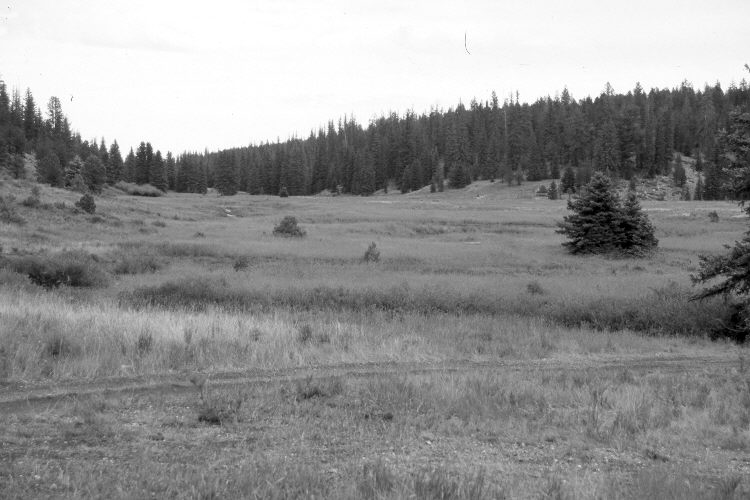
Swains Creek
1961
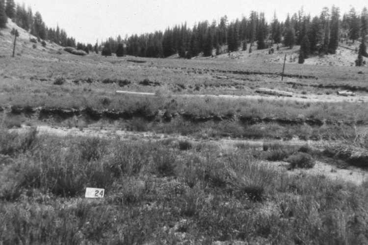
2005
Description:
Plate 980X. Swains Creek 1961 – 2005 Viewed northeast down Swains Creek below Utah Highway 14. Willows have increased, especially along the streambank nearest the camera. In general, the creek appears more vegetated today than it did in the past. Juniper, spruce, and ponderosa pine have increased. Most of the bottoms are smooth brome. The area was grazed by sheep in 2005. An ATV trail has been added. The most common grass in the foreground is needle and thread. Green rabbitbrush is also present. The photopoint is marked with a steel fence post.
Photo Information:
U.S. Forest Service photograph (unnumbered) taken by Rance Rollins on August 9, 1961; retake by Charles E. Kay on July 31, 2005 - - Photo No. 5495-22. Original photographs, negatives, and narrative reports held in the range files on the Cedar City Ranger District, Dixie National Forest, Cedar City, UT.
Vegetative Community:
Riparian, Juniper, Conifer, Dry Meadow
Location:
South West: Section 14, Range 7 West, Township 38 South; UTM 359100 E, 4151650 N; elevation 7,660 ft.