Swains Creek
1954
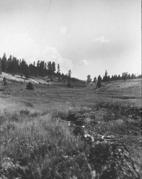
2005
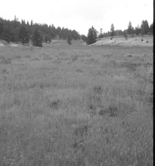
Description:
Plate 956X. Swains Creek 1954 – 2005 Viewed north-northeast down Swains Creek from the dike on the pond below Tar Kiln Hollow. Intermediate wheatgrass and smooth brome are the most common grasses in the meadow. Green and rubber rabbitbrush are also present. Spruce and ponderosa pine have increased in the distance.
Photo Information:
U.S. Forest Service photograph (unnumbered) taken in July 1954; retake by Charles E. Kay on July 29, 2005 - - Photo No. 5488-1. Original photographs, negatives, and narrative reports held in the range files on the Cedar City Ranger District, Dixie National Forest, Cedar City, UT.
Vegetative Community:
Dry Meadow, Conifer
Location:
South West: Section 4, Range 7 West, Township 39 South; UTM 354600 E, 4145000 N; elevation 7,840 ft.
January 2018