Sunflower Pass
1957
2003
Description:
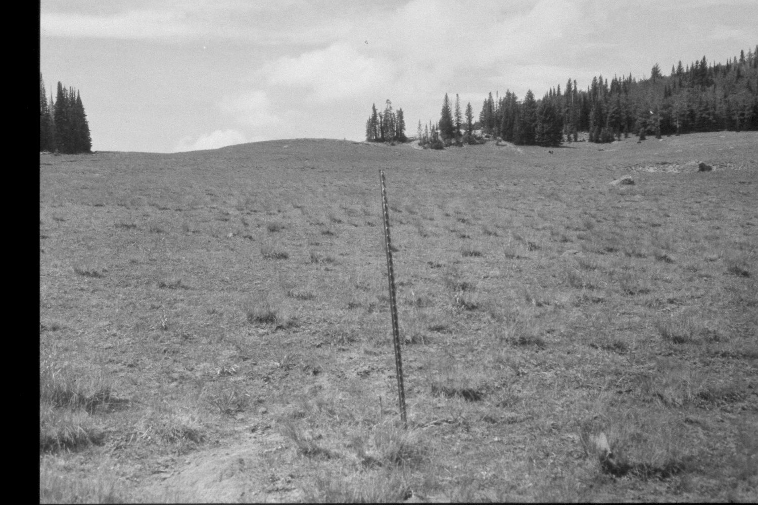
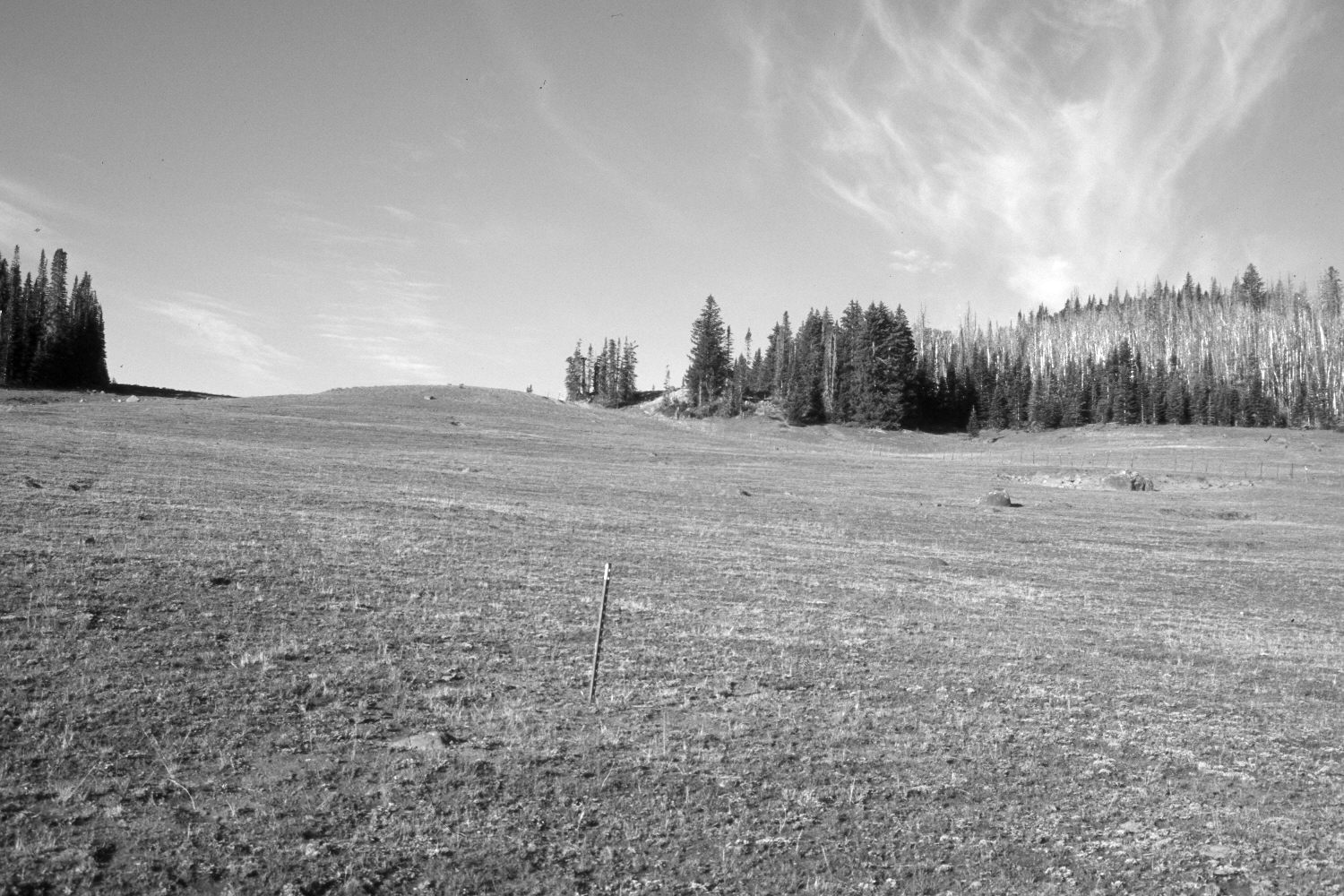
Plate 363X. Sunflower Pass 1957 - 2003 Viewed southwest to Sunflower Pass on the eastern flank of Boulder Mountain. Sunflower Flat is on the far side of the pass. The original image is part of an old, Parker 3-step range transect. Spruce has increased in the distance, while aspen has declined. Part of the forest on the right was prescribe-burned in July 1997. The 4x4 road on the left edge of the photo has eroded and been closed by the Forest Service for several years. The area was heavily grazed by cattle in 2003. A new allotment fence is visible in the retake. Aspen is regenerating in the burned area, as the thickets of fire-killed trees limit access by livestock, as well as elk and mule deer. Range conditions in 2003 were also effected by the drought that has gripped southern Utah for several years.
Photo Information:
U.S. Forest Service photograph (unnumbered) taken in 1957; retake by Charles E. Kay on August 28, 2003 - - Photo No. 5263-13. Original photograph held in the range files on the Teasdale Ranger District, Dixie National Forest, Teasdale, UT.
Vegetative Community:
Conifer, Aspen, Dry Meadow
Location:
South West: Section 3, Range 5 East, Township 32 South; UTM 470100E, 4211000 N; elevation 10,040 ft.