Steep Creek
1935
2002
Description:
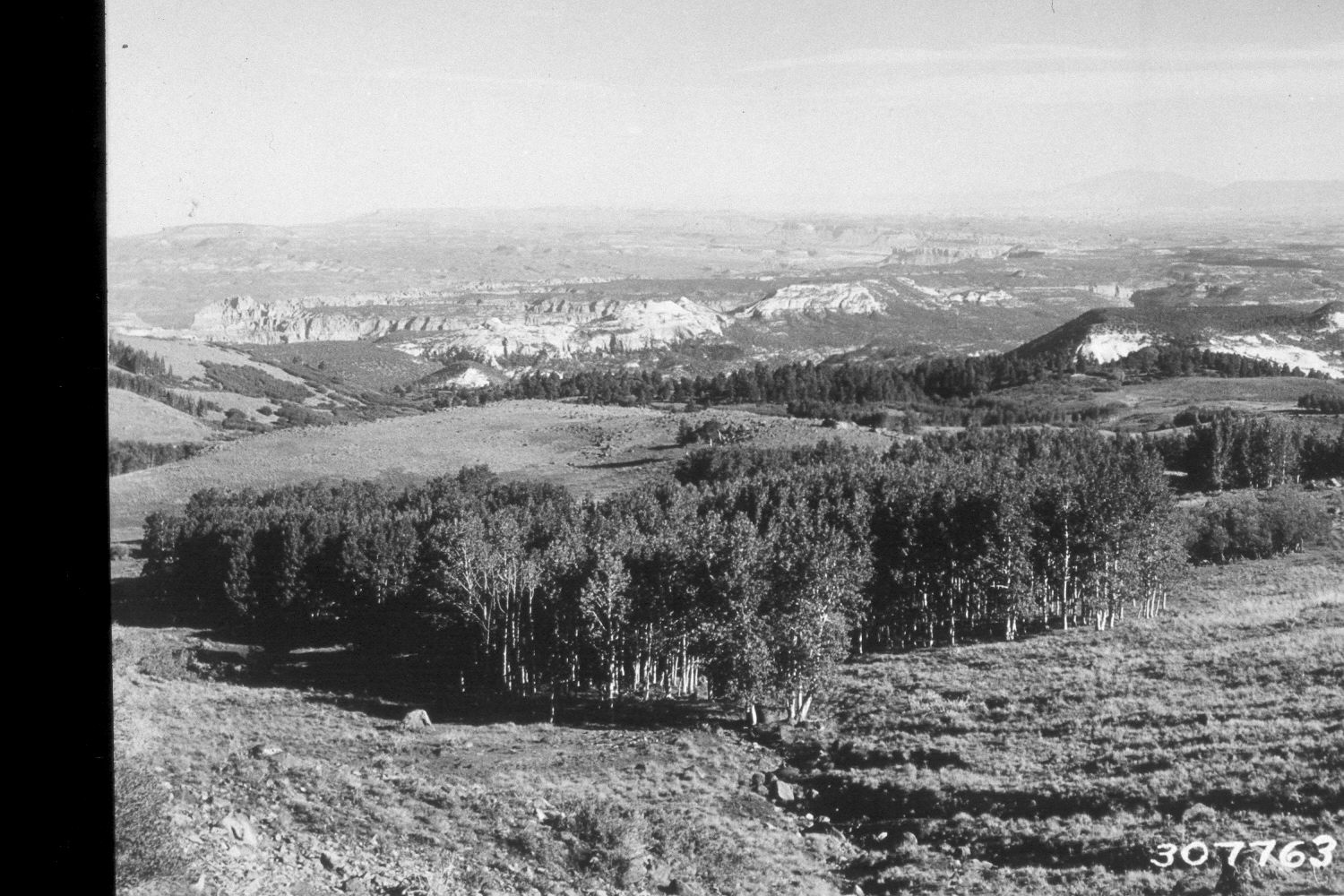
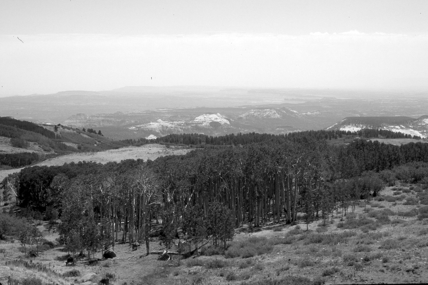
Plate 35X. Steep Creek 1935-2002 Viewed southeast down Steep Creek on the eastern flank of Boulder Mountain near milepost 100 on Utah Highway 12. Snowberry has increased in the foreground. This occurred after the area was switched from a domestic sheep to a cattle allotment - - note the cattle in the retake (photo lower-left). Willows in the distance appear unchanged. A few aspen stands successfully regenerated during the late 1970’s when mule deer numbers were low, but many did not due to excessive ungulate herbivory (Kay and Bartos 2000). The conifers, in the distance, are ponderosa pine, which generally occur below the aspen zone on Boulder Mountain.
Photo Information:
U.S. Forest Service photograph 307763 taken by K.D.Swan in August 1935; retake by Charles E. Kay on July 9, 2002 - - Photo No. 4964-34. Original photograph held by U.S. Forest Service Regional Photographic Collection (2310-Dixie-206) housed at Weber State University, Ogden, UT.
Vegetative Community:
Riparian, Aspen, Conifer
Location:
South West: Section 15, Range 5 East, Township 32 South; UTM 469800E, 4208700N; elevation 9,360 ft.