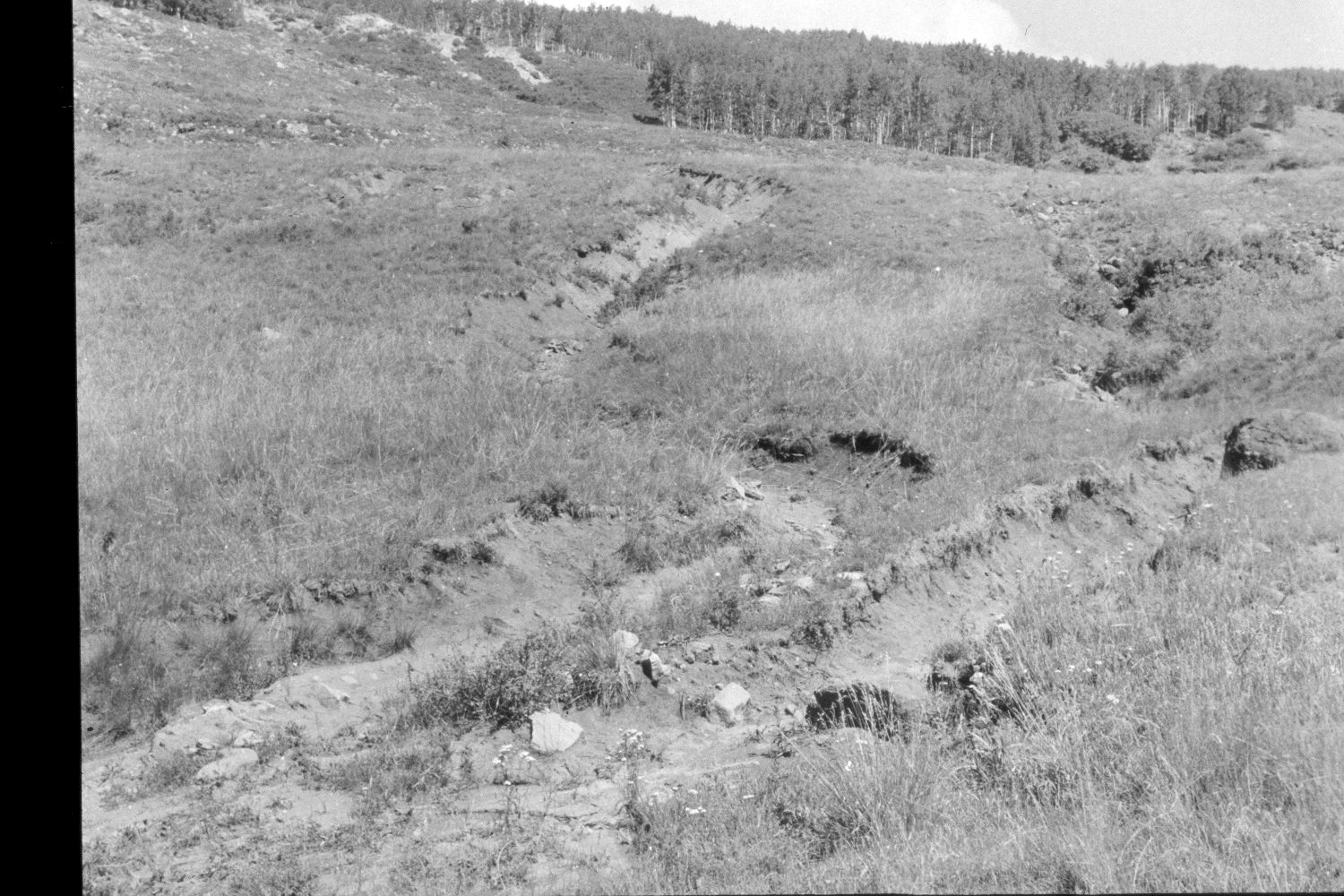
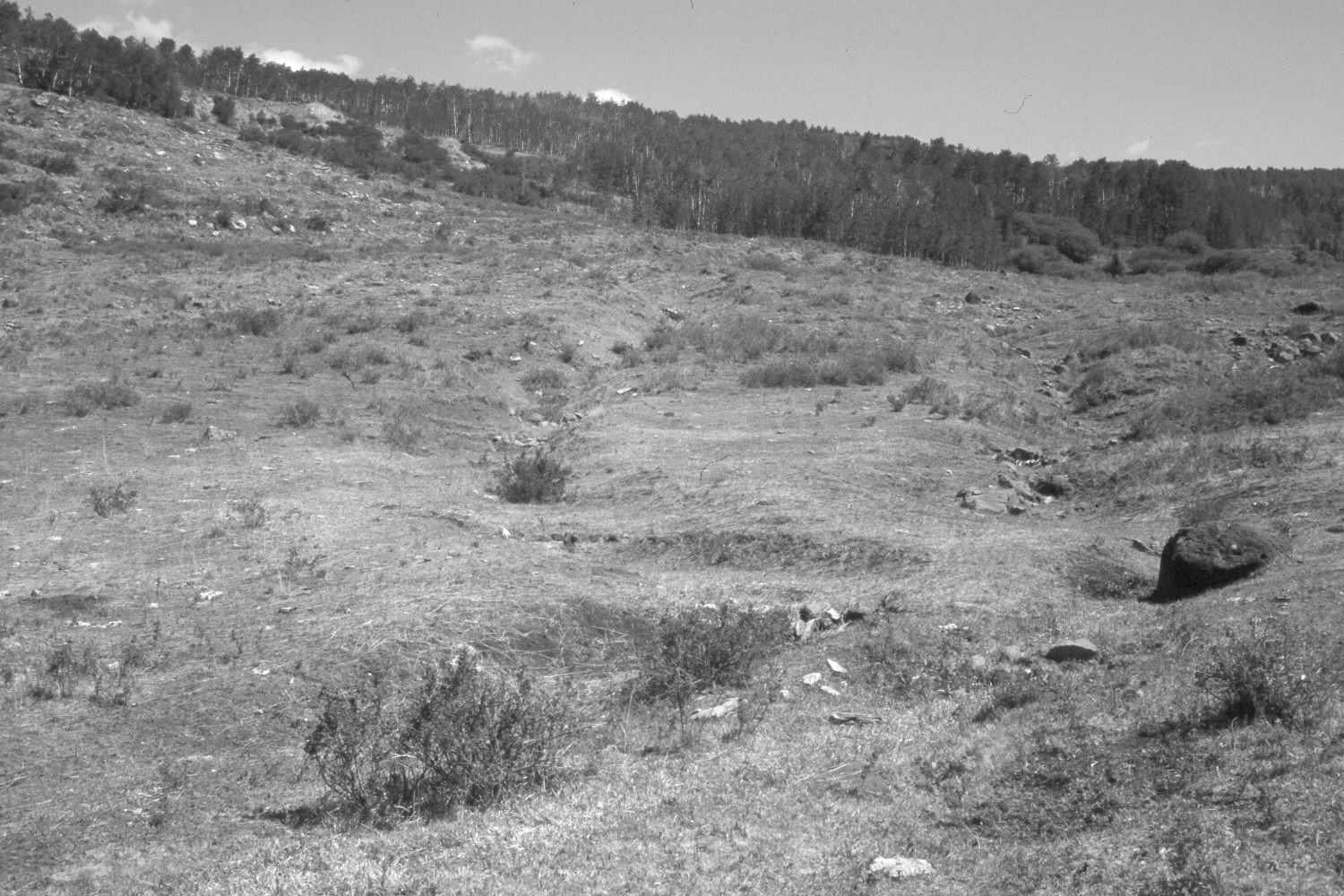
Steep Creek
ca. 1960
2002
Description:
Plate 21X. Steep Creek ca. 1960-2002 Viewed northeast across upper Steep Creek drainage on the southern flank of Boulder Mountain. Note the extensive gullying and soil erosion in the original photo. The area was contour-trenched, gully-plugged, and reseeded by the Forest Service in 1962 - - note the large boulder (photo-right) in both images. Shrubs, primarily snowberry and rose (Rosa spp.), are more abundant today than they were in the past. Willows in the distance appear unchanged, while most aspen stands successfully regenerated during the late 1970’s when mule deer us declined (Kay and Bartos 2000). Active soil erosion appears to have ceased.
Photo Information:
U.S. Forest Service photograph (unnumbered) taken ca. 1960; retake by Charles E. Kay on July 8, 2002 - - Photo. No. 4962-4. Original photograph held by Southern Utah University Archives and Special Collections, Cedar City, UT.
Vegetative Community:
Mountain Brush, Riparian, Aspen
Location:
South West: Section 15, Range 5 East, Township 32 South; UTM 469600E, 4209000N; elevation 9,400 ft.