South Last Chance
1962
1999
Description:
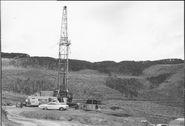
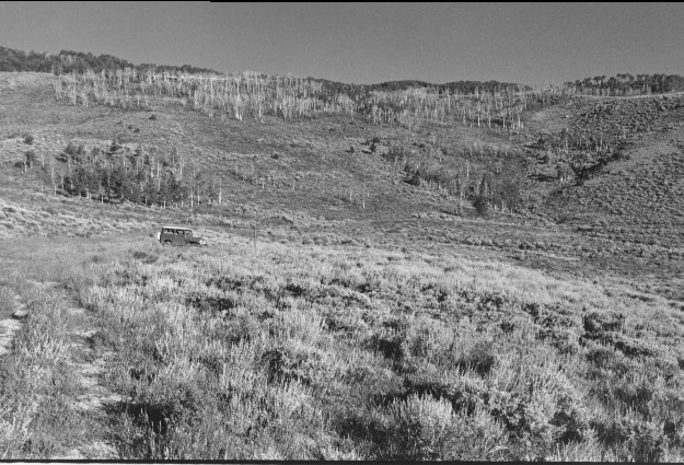
Plate 99. SOUTH LAST CHANCE: 1962 - 1999 The 1962 photo shows an oil well drill site in the South Last Chance drainage. The old road and drill pad have revegetated naturally. The 1999 photo shows a sealed well pipe (it was a dry hole) in front of the Toyota Landcruiser. Much of the far hillside was burned sometime prior to 1999 by the Forest Service, which accounts for the dead aspen (Populus tremuloides) trees in the 1999 photo. These burned aspen have been unable to produce new stems more than 6 feet tall, indicating unsuccessful regeneration.
Photo Information:
1962 photo taken by the U.S. Forest Service; 1999 photo is Kay #4470-35, taken on Aug. 12. Forest Service photo held by the Loa Ranger District, Fishlake National Forest, Loa, UT.
Vegetative Community:
Conifer, Aspen, Sagebrush
Location:
South Central: Fishlake National Forest, Loa Ranger District, T25S, R4E, Sect. 8, UTM 4277850 N, 457600 E; elevation 9,100 ft., viewed to northwest.