South Fork Of City Creek Beaver Mountain
1962
2000
Description:
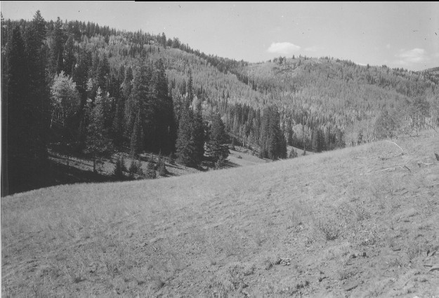
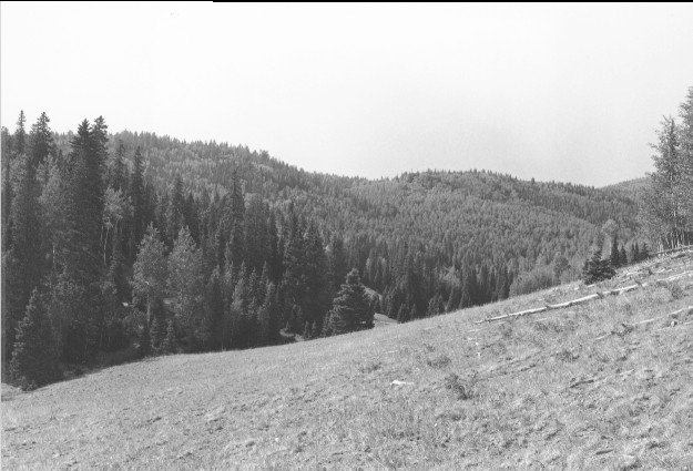
Plate 229. SOUTH FORK OF CITY CREEK BEAVER MOUNTAIN 1962-2000 Viewed northwest down the upper portion of the South Fork of City Creek on Beaver Mountain near Utah Highway 153. Conifers have increased and invaded most aspen stands. Aspen has increased in height but otherwise declined.
Photo Information:
U.S. Forest Service photo (unnumbered) taken by Glenn C. Kull on September 17, 1962; retake by Charles E. Kay on August 1, 2000 - - Photo No. 4653-34; Original photo (2400-V) held by Beaver Ranger District, Fishlake National Forest, Beaver, UT.
Vegetative Community:
Conifer, Aspen
Location:
South Central: Section 36, Range 5 W, Township 29 S; UTM 380600 E, 4233000 N; elevation 9,560 ft.
January 2018