Shiver Creek
1942
2006
Description:
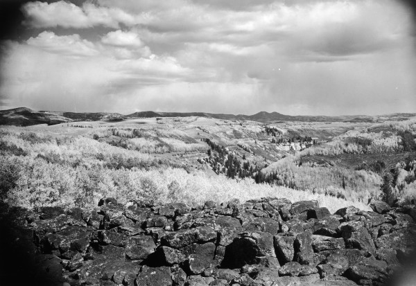
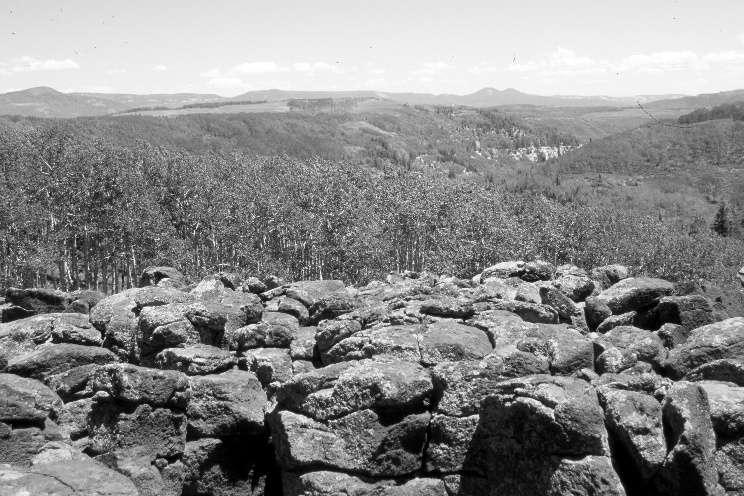
Plate 1316X. Shiver Creek 1942 – 2006 Viewed east down Shiver Creek on Cedar Mountain. Black Mountain (10,400 ft) is on the left skyline, while Navajo Peak (10,388 ft) is on the right-center. The road-cut for Utah Highway 14 is visible in the distance. Aspen has increased in height but most stands have not successfully regenerated for many years due to excessive ungulate herbivory (Ohms 2003). Oakbrush in the distance has increased, as have conifers. Aspen saplings now block the original view, so the retake was made a few feet forward. The haze in the retake is from wildfires in Nevada.
Photo Information:
Original photograph taken by Gregory (No. 1132) in 1942; retake by Charles E. Kay on July 12, 2006 - - Photo No. 5686-12. Original photograph held by the U.S. Geological Survey Photographic Library, Denver, CO.
Vegetative Community:
Aspen, Conifer
Location:
South West: Section 1, Range 11 West, Township 38 South; UTM 318750 E, 4154500 N; elevation 9,200 ft.