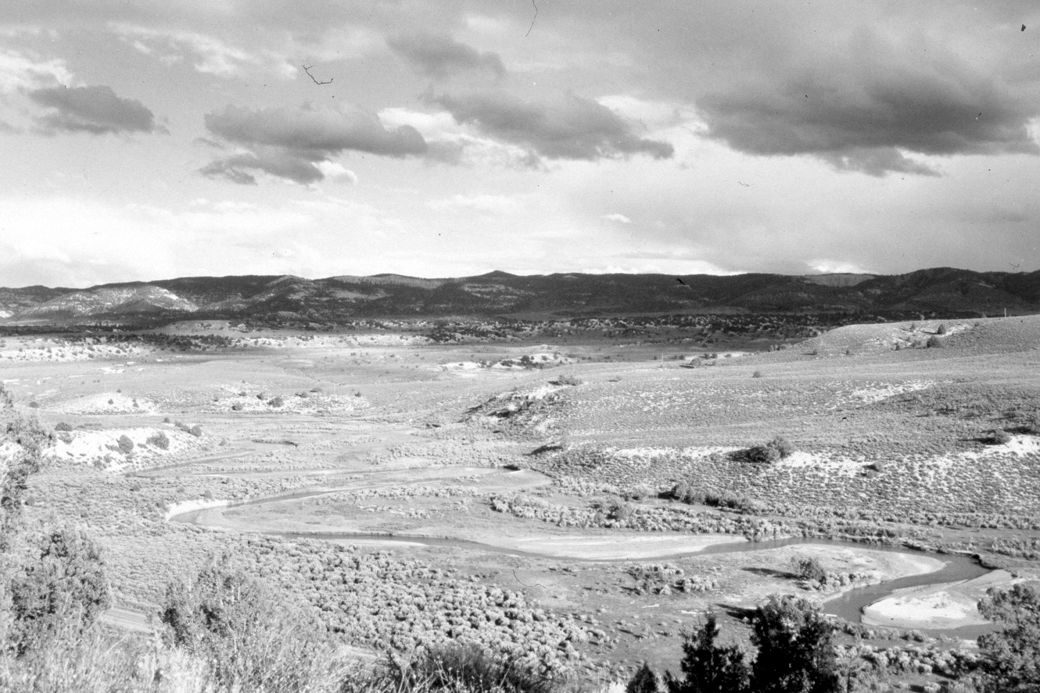
Sevier River
1940
2004
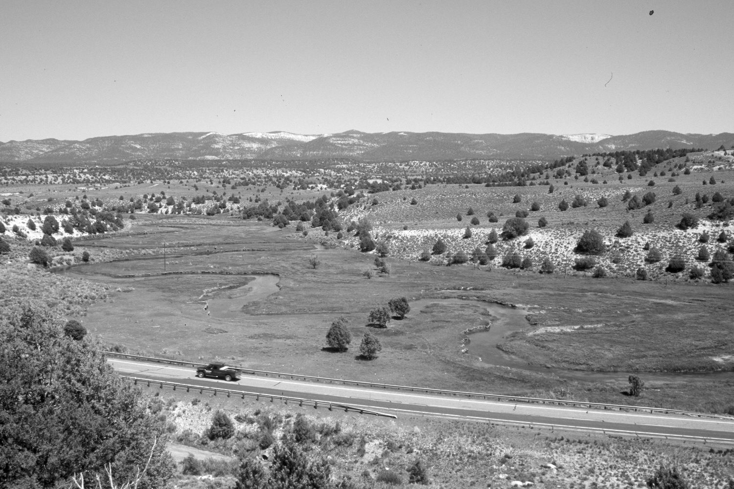
Description:
Plate 490X. Sevier River 1940 – 2004 Viewed east-northeast down the Sevier River from just below Asay Creek. The Paungaugunt Plateau is in the distance. Pinyon and juniper now block the original camera station, so the retake was made from the nearest open area, which accounts for the slightly different perspective. Pinyon and juniper have increased, while mountain big sage has declined on the floodplain. U.S. Highway 89 has been realigned. The stream banks appear more heavily vegetated today than in the past despite yearly grazing by cattle.
Photo Information:
Original photograph taken by H.E. Gregory (No. 1006) in 1940; retake by Charles E. Kay on June 8, 2004 - - Photo No. 5337-17. Original photograph held in the U.S. Geological Survey Photograph Library, Denver, CO.
Vegetative Community:
Pinyon, Juniper, Riparian, Sagebrush
Location:
South West: Section 13, Range 6 West, Township 37 South; UTM 369850 E, 4161100 N; elevation 7,120 ft.