Sevier River
1944
2004
Description:
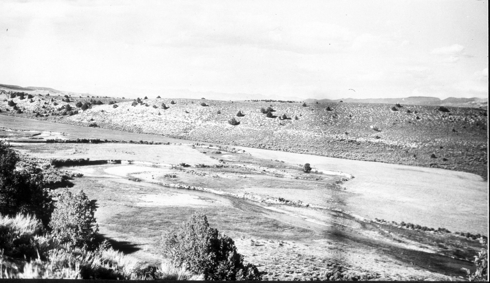
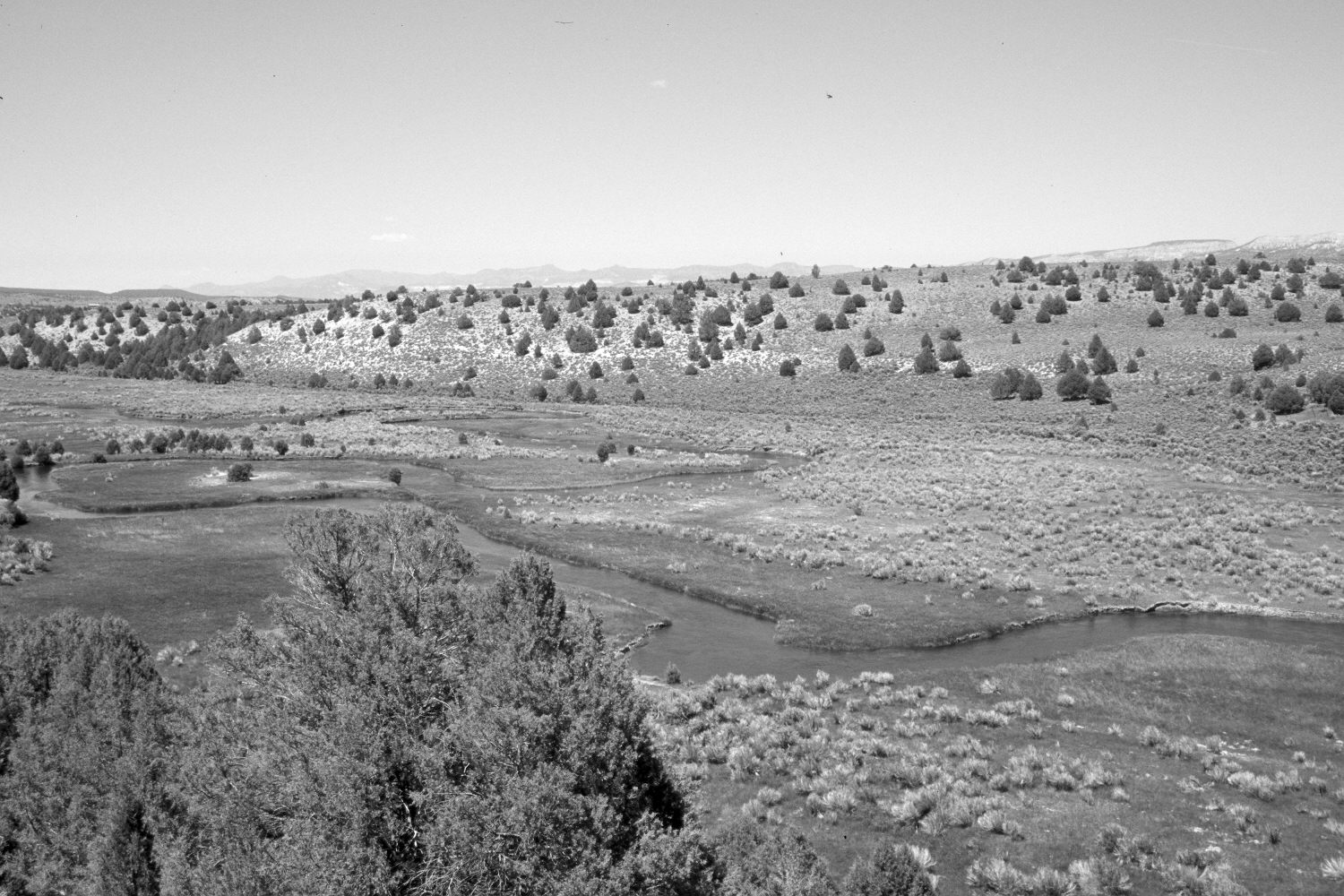
Plate 489X. Sevier River 1944 – 2004 Viewed north-northeast down the Sevier River about four miles south of Hatch, UT. Wilson Peak is on the right skyline, while Mount Dutton is in the distance - - photo left-center. Pinyon and juniper now block the original camera station, so the retake was made from the nearest open area, which accounts for the slightly different perspective. The stream banks appear more heavily vegetated today than they did in the past. The agricultural fields have been abandoned and colonized by mountain big sage and rubber rabbitbrush. Pinyon and juniper have increased. .
Photo Information:
Original photograph taken by H.E. Gregory (No. 1250) in 1944; retake by Charles E. Kay on June 6, 2004 - - Photo No. 5337-23. Original photograph held in the U.S. Geological Survey Photograph Library, Denver, CO
Vegetative Community:
Pinyon, Juniper, Riparian, Sagebrush
Location:
South West: Section 13, Range 6 West, Township 37 South; UTM 370350 E, 4161350 N; elevation 7,020 ft.