Sevier River
1914
2004
Description:
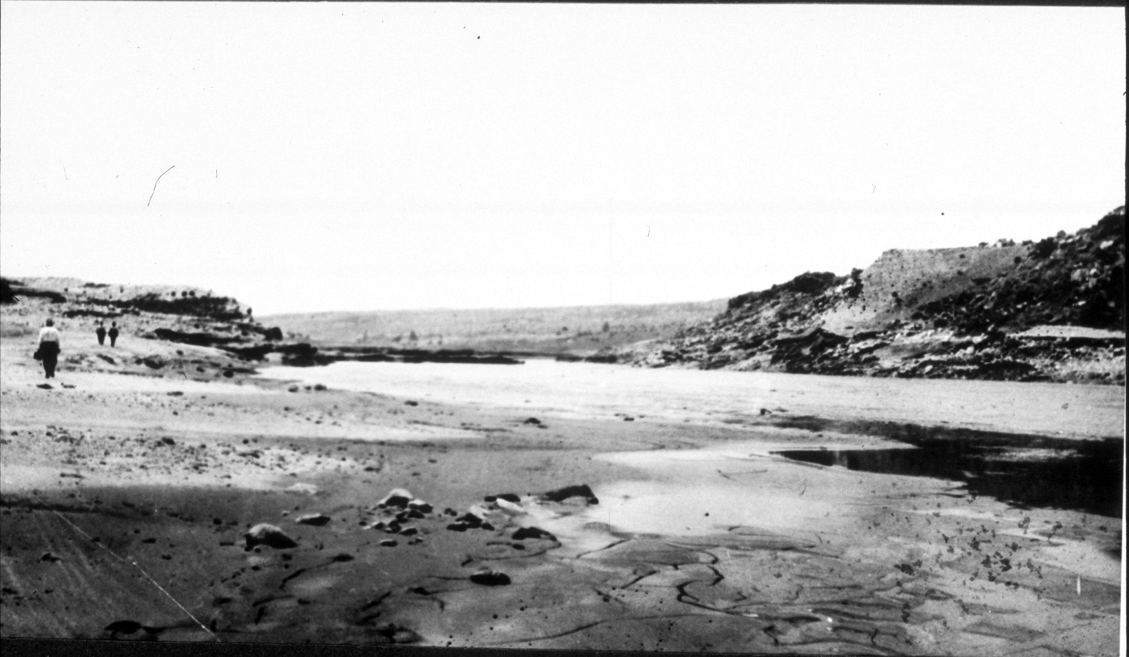
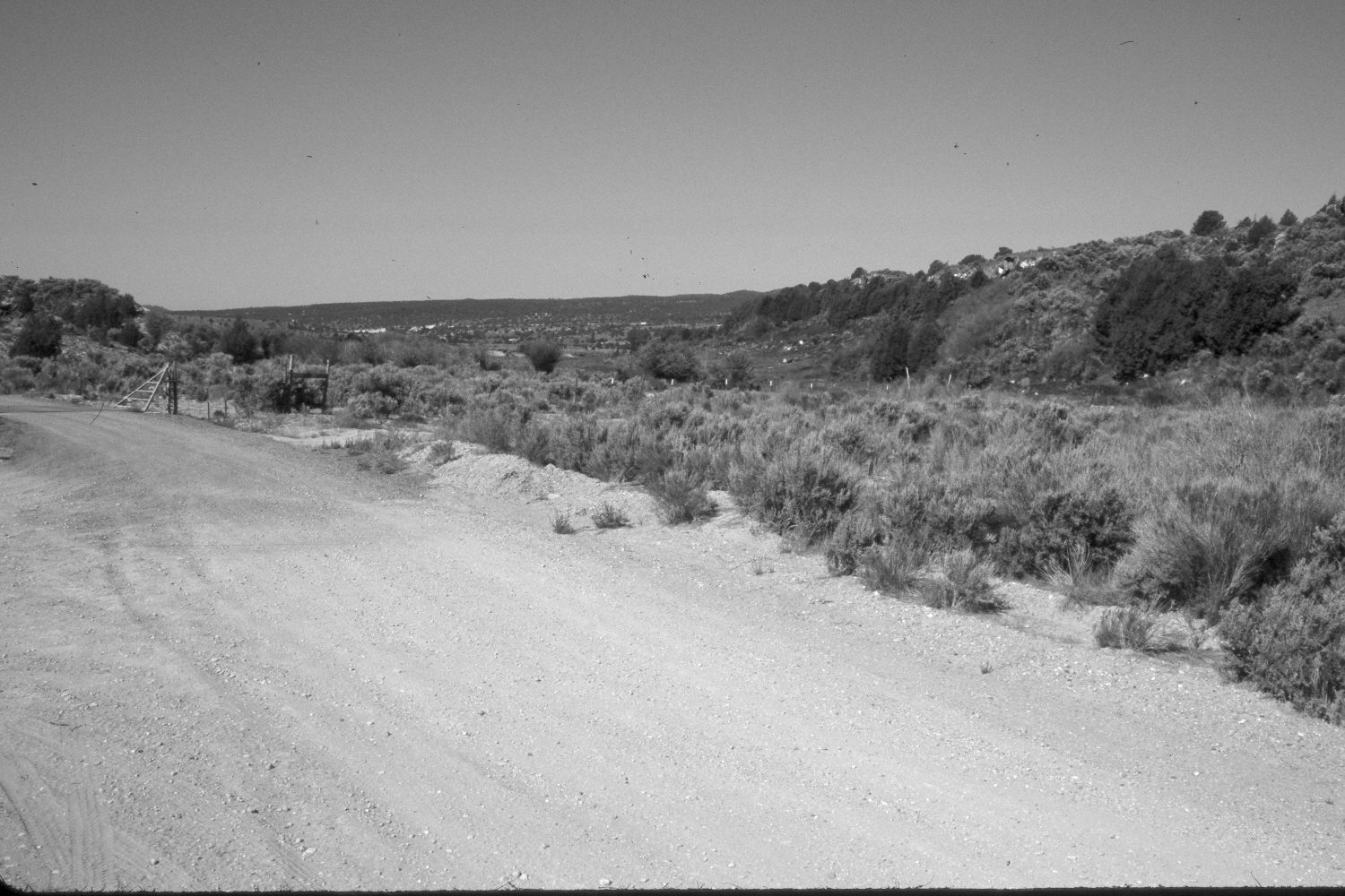
Plate 485X. Sevier River 1914 – 2004 Viewed southwest to the old dam site on the Sevier River south of Hatch, UT. The dam failed in 1914 and has not been rebuilt. The stream channel has stabilized and is more heavily vegetated today than in the past. Willows have increased, as have pinyon, juniper, Wyoming big sage, four-wing saltbrush, and rubber rabbitbrush. The river channel is now on the far right near the base of the hill. A county road has been added in the foreground. The area above the fence is grazed by livestock, while the area below the fence is not.
Photo Information:
Original photograph taken by an unknown photographer in 1914 shortly after the dam collapsed; retake by Charles E. Kay on June 8, 2004 - - Photo No. 5335-30. Original photograph (No. 16679) held by the Utah Historical Society, Salt Lake City, UT.
Vegetative Community:
Riparian, Pinyon, Juniper, Sagebrush
Location:
South West: Section 32, Range 5 West, Township 36 South; UTM 373000 E, 4165500 N; elevation 6,930 ft.