Sevier River
1920
2002
Description:
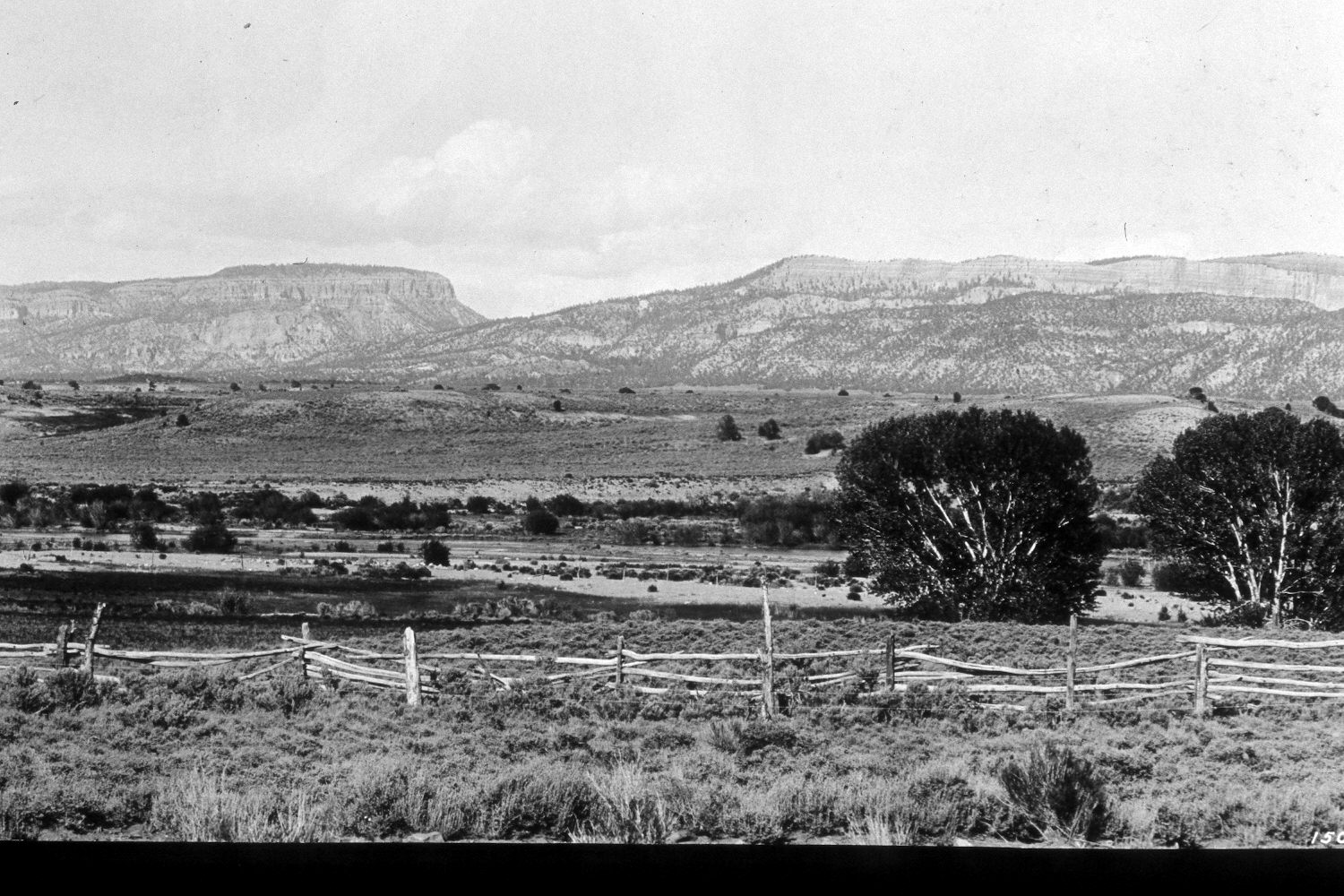
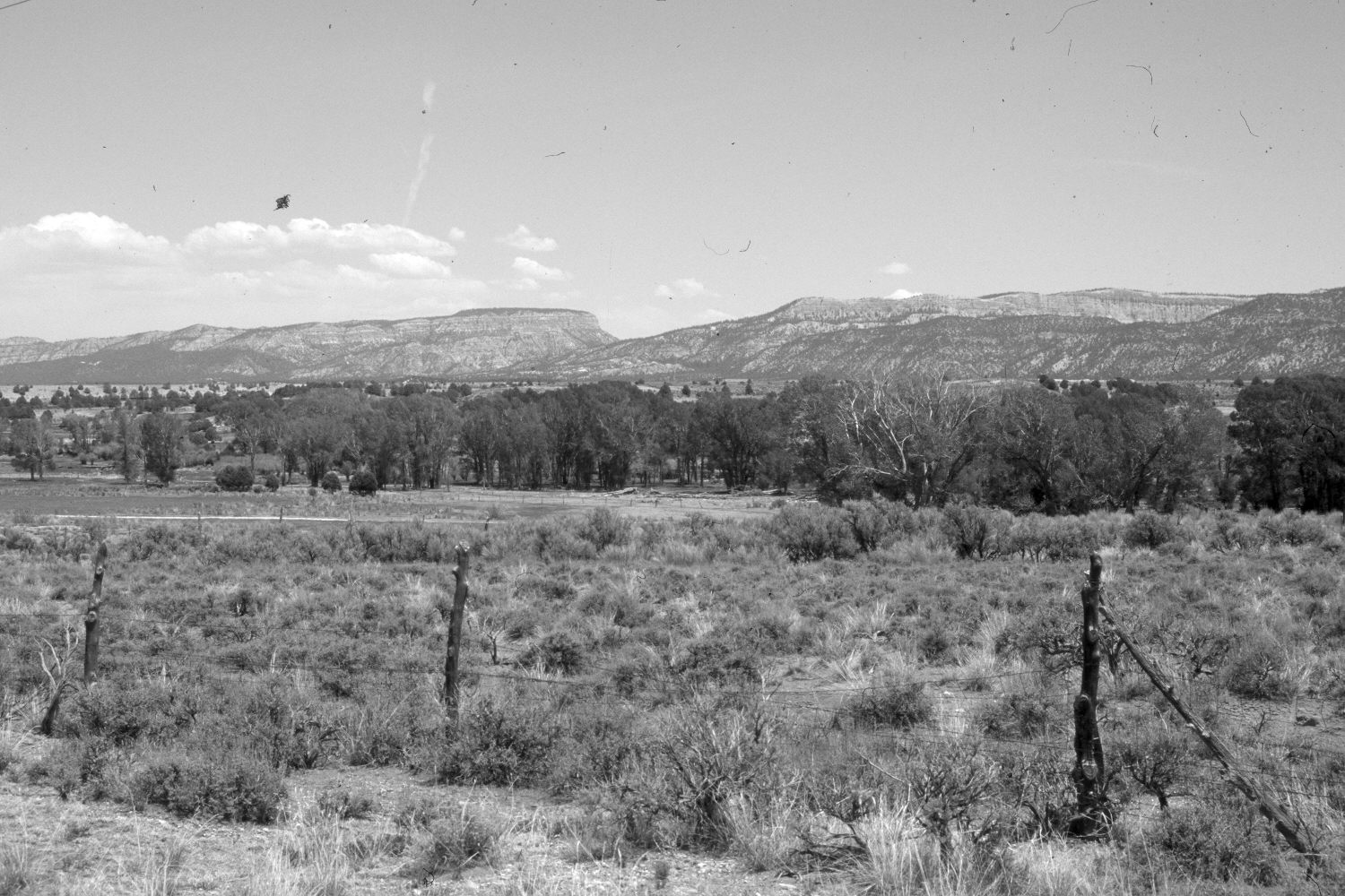
Plate 1X. Sevier River 1920-2002 Viewed northeast south of Hatch, Utah to Wilson Peak (9,034 ft.), Sunset Cliffs, and the Paunsaugunt Plateau. Cottonwoods (Populus spp.) have increased along the Sevier River, as has Russian Olive (Elaeagnus augustifolia). Pinyon (Pinus spp.) and juniper (Juniperus spp.) have increased on the hillsides east of the river, although that view is obscured in the retake by the new growth of trees near the river. The area in the foreground is a mixture of big (Artemisia tridentata) and black sage (A. nova), while the area behind the original fence is now primarily rubber rabbitbrush (Chrysothamnus nauseosus). Willows (Salix spp.) appear more heavily grazed today than they did in the past. The original fence has been replaced by a new, wire fence that is largely hidden from view by tall shrubs. The fence in the foreground of the retake parallels U.S. Highway 89. U.S. Forest Service photograph 150415 taken in 1920 by E.S. Shipp; retake by Charles E. Kay on May 31, 2002 - - Photo No. 4930-20.
Photo Information:
Original photo held by Southern Utah University Archives and Special Collections, Cedar City, UT and the U.S. Forest Service Regional photograph collection (2310-Dixie-50) housed at Weber State University, Ogden, UT. The original photo is also in the U.S. Geological Survey’s photographic Library at Denver, CO, where it is misidentified as H.E. Gregory 1296. According to the note in the U.S.G.S. Library, the original photograph was published as Figure 43 in U.S. Geological Survey Professional Paper 226 in 1951.
Vegetative Community:
Riparian, Pinyon, Juniper, Sagebrush
Location:
South West: