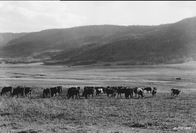
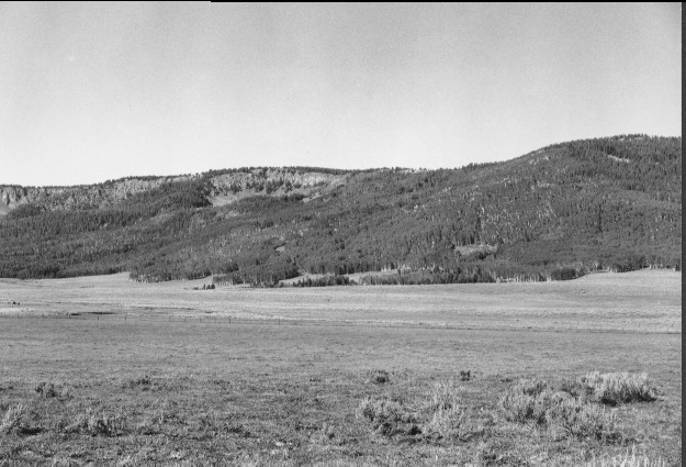
Sevenmile Valley
1930
2000
Description:
Plate 186. SEVENMILE VALLEY 1930-2000 Plates 185 and 186 form a panorama and are viewed southwest-west across Sevenmile Valley to Sevenmile Cirques, similar to Plates 25, 26, and 184. New pasture fences have been added but the area is still heavily used by cattle. The creek, which is dry at this point, appears more stable today than it did in the original. Conifers have increased on the distant hillside, while aspen has declined. Many of the conifers are now being killed by insects and disease.
Photo Information:
U.S. Forest Service photo 253130 taken in 1930; retake by Charles E. Kay on July 27, 2000 - - Photo No. 4637-9. Original photo (2200 Fishlake-13) held by the Forest Service Regional Office Photographic Collection housed at Weber State University, Ogden, UT.
Vegetative Community:
Conifer, Aspen
Location:
South Central: Section 34, Range 2 E, Township 24 S; UTM 441700 E, 4281850 N; elevation 9,460 ft.