Sand Pass
1964
2003
Description:
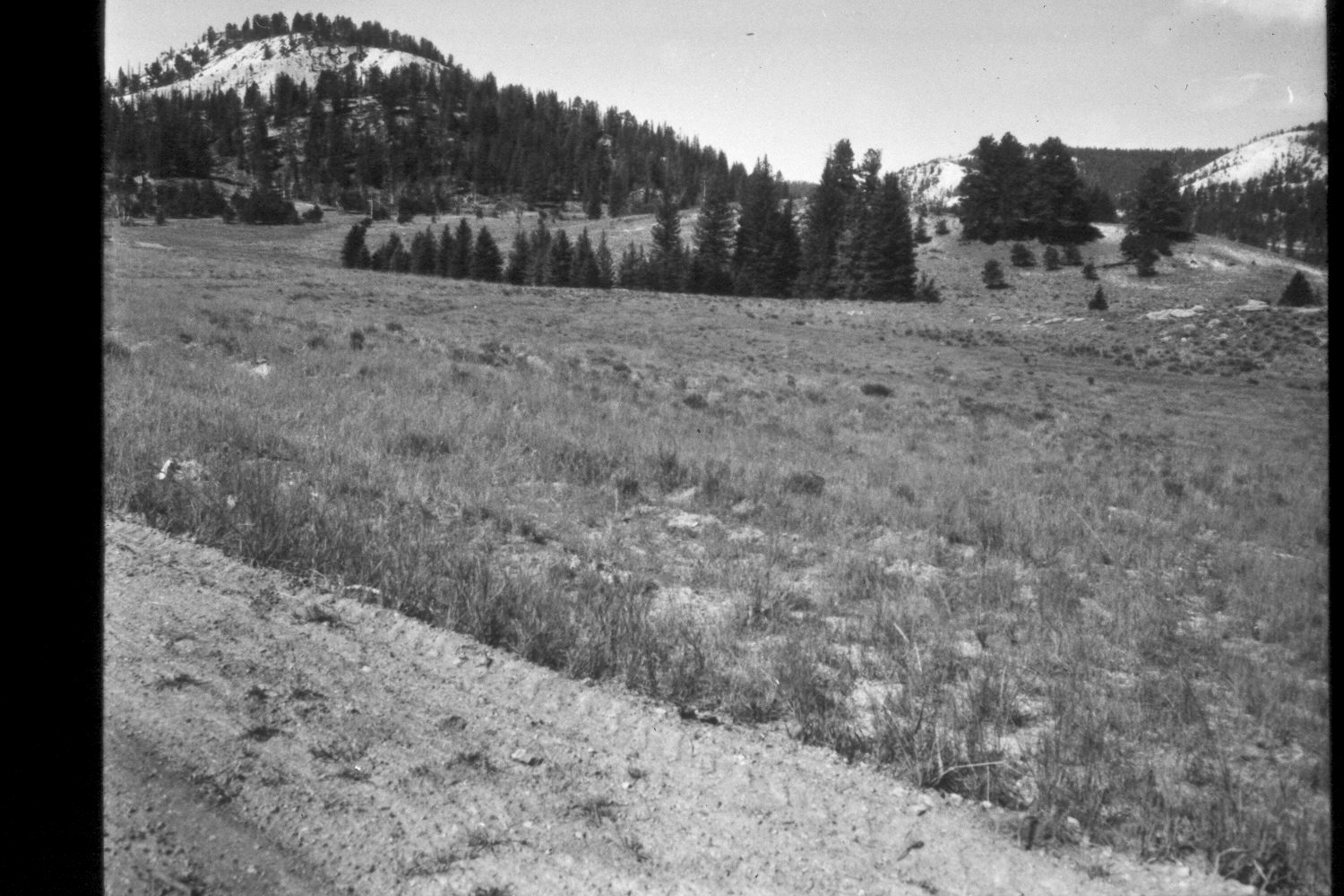
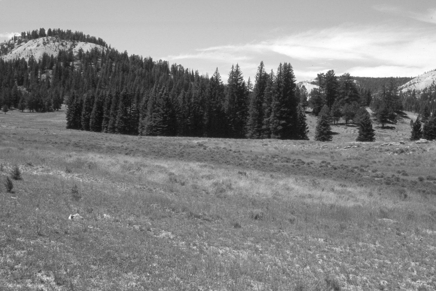
Plate 277X. Sand Pass 1964 - 2003 Viewed southwest from the lower, northeast side of Sand Pass on the Paunsaugunt Plateau. The camera station is on an old logging road that has been abandoned and reseeded. Despite selective logging, spruce and ponderosa pine have increased. Some of the open areas have been treated and reseeded by the Forest Service to control erosion and improve range conditions. The planted grasses are mainly intermediate wheatgrass and smooth brome. Native needle and thread is also present. The low shrubs are mostly rubber rabbitbrush and shrubby cinquefoil, with mountain big sage on the drier slopes.
Photo Information:
U.S. Forest Service photographs (unnumbered) taken by G. Glad Quilter in 1964; retake by Charles E. Kay on August 6, 2003 - - Photo No. 5223-10. Original photograph held in the range files on the Panguitch Ranger District, Dixie National Forest, Panguitch, UT.
Vegetative Community:
Conifer, Dry Meadow, Sagebrush
Location:
South West: Section 35, Range 4½ West, Township 37 South; UTM 385650E, 4155800 N; elevation 8,080 ft.