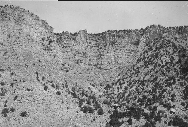
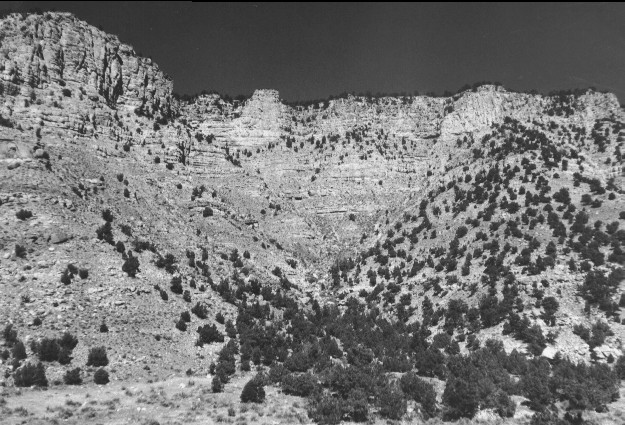
Salina Creek
1923
1996
Description:
Plate 41. SALINA CREEK: 1923 - 1996 This is the same photo point as that for Plate 40, except this view is to the north across Salina Creek. Interstate I-70 in the 1996 photo is out of view and thus has not disturbed the vegetation as seen in the 1923 photo. The coal mine and access road visible in the 1923 photo has been naturally revegetated by 1996. Pinyon (Pinus edulis) and juniper (Juniperus sp.) has increased on the lower alluvial fan since 1923, but otherwise apparently little has changed on the steep, south-facing hillsides.
Photo Information:
1923 photo taken by Spieker #75; 1996 photo is Kay #4077-23, taken on Sept, 26. Spieker photo held by the U.S. Geological Survey Photographic Archives, Denver CO.
Vegetative Community:
Pinyon, Juniper, Sagebrush
Location:
South Central: Below Dead Horse Canyon, Fishlake N.F, Richfield R.D., T22S, R2E., Sect. 15, UTM 4305850 N, 441600 E; elevation 6,200 ft.; view to north.