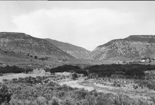
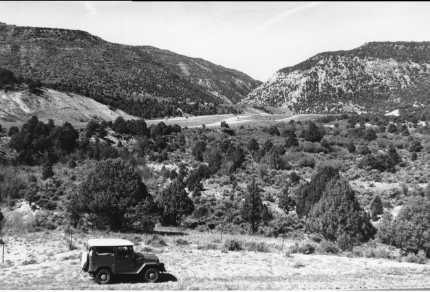
Salina Creek
1923
1996
Description:
Plate 38. SALINA CREEK: 1923 - 1996 Salina Creek is on the right while Meadow Creek flows in from the left. In 1923 both streams were severely eroding their channels; down cutting continued and neither creek is visible in the 1996 photo. The dense stand of willow (Salix spp.) and birch (Betula sp.) present below the confluence of the two streams in 1923 has practically disappeared by 1996, and pinyon (Pinus edulis) and juniper (Juniperus sp.) has invaded the area. (A down cutting stream lowers the water table, thereby adversely affecting the riparian vegetation; then, in the absence of fire, pinyon and juniper are able to invade this drier site.) The view is down Salina Canyon with interstate highway I-70 visible in the 1996 photo. A new road has been built in the foreground which destroyed the original photo point.
Photo Information:
1923 photo taken by Spieker #73; 1996 photo is Kay #4069-29, taken on Sept, 26. Spieker photo held by the U.S. Geological Survey Photographic Archives, Denver CO.
Vegetative Community:
Riparian, Sagebrush, Pinyon, Juniper
Location:
South Central: Hilgard Mountain, Fishlake N.F, Richfield R.D., T23S, R3E., Sect. 23, UTM 4303000 N, 452150 E; elevation 6,8020 ft.; view to west.