Roundup Flat
1964
2002
Description:
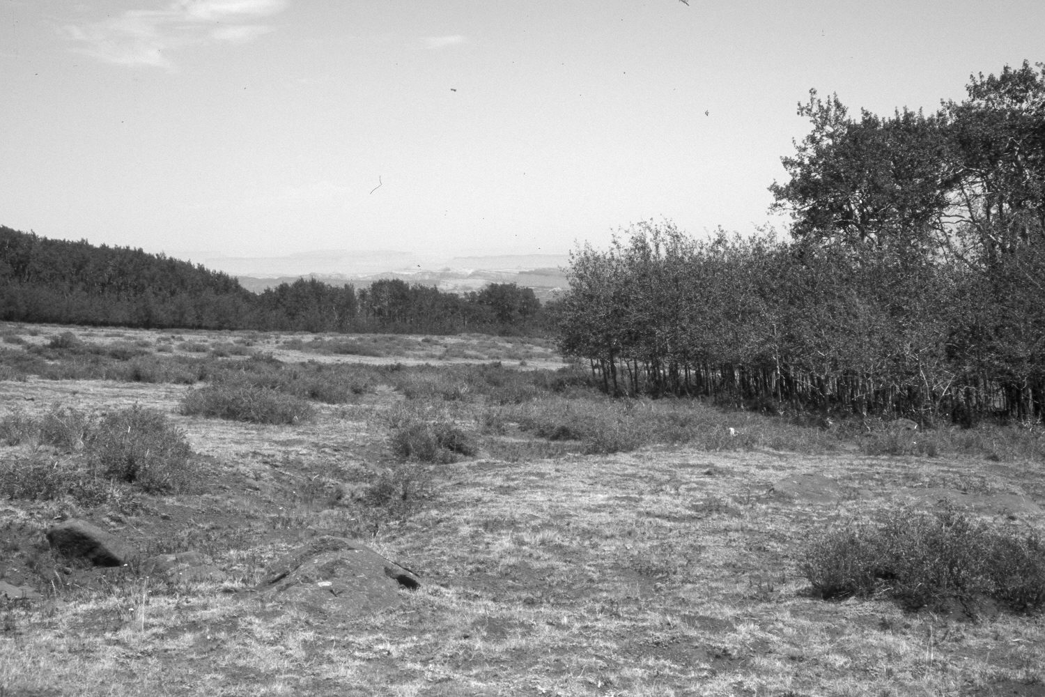
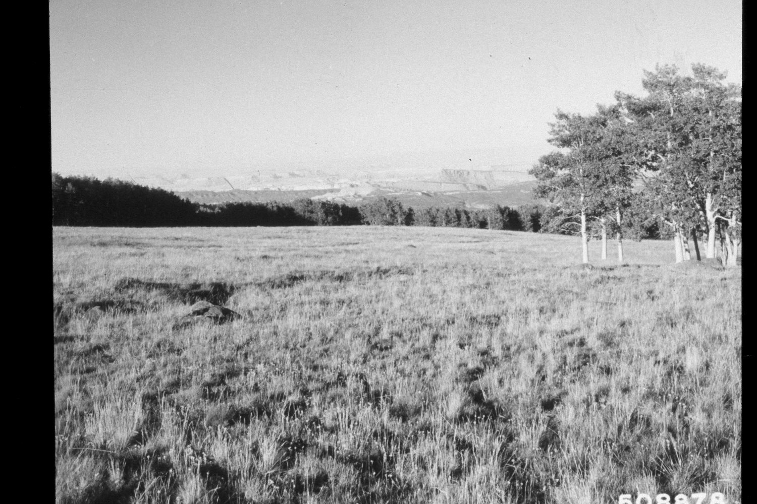
Plate 27X. Roundup Flat 1964-2002 Viewed northeast across Roundup Flat on the east flank of Boulder Mountain. grasses have declined while shrubs, primarily snowberry, have increased. The area was heavily grazed by cattle in 2002. Aspen regenerated during the late 1970’s when mule deer numbers were low (Kay and Bartos 2000). U.S. Forest Service photograph 508878 taken by Prater in August 1964; retake by Charles E. Kay on July 9, 2002 - - Photo No. 4964-29. Section 11, Range 5 East, Township 32 South; UTM 471400E, 4210500N; elevation 9,560 ft. Original photograph held by Southern Utah University Archives and Special Collections, Cedar City, UT. Roundup Flat 1964-2002 Viewed northeast across Roundup Flat on the east flank of Boulder Mountain. grasses have declined while shrubs, primarily snowberry, have increased. The area was heavily grazed by cattle in 2002. Aspen regenerated during the late 1970’s when mule deer numbers were low (Kay and Bartos 2000).
Photo Information:
U.S. Forest Service photograph 508878 taken by Prater in August 1964; retake by Charles E. Kay on July 9, 2002 - - Photo No. 4964-29. Original photograph held by Southern Utah University Archives and Special Collections, Cedar City, UT.
Vegetative Community:
Mountain Brush, Aspen
Location:
South West: Section 11, Range 5 East, Township 32 South; UTM 471400E, 4210500N; elevation 9,560 ft.