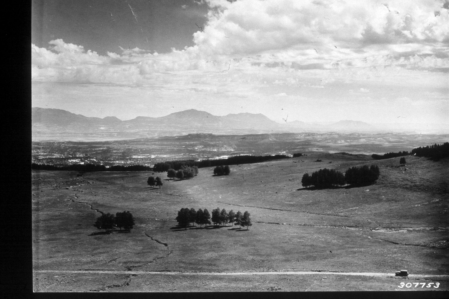
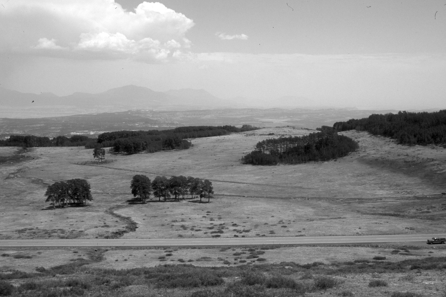
Roundup Flat
1935
2002
Description:
Plate 32X. Roundup Flat 1935-2002 Viewed southeast across Roundup Flat with the Henry Mountains in the distance. Plates 31x and 32x form a panorama. The area was heavily grazed by domestic sheep in 1935 - - note the gullying and active soil erosion, which has since ceased. The area was grazed by cattle in 2002. Snowberry has increased, especially in the foreground. Many aspen stands regenerated during the late 1970’s when mule deer numbers were low, but not the clones on the flat where cattle tend to concentrate. Utah Highway 12 has been improved and paved.
Photo Information:
U.S. Forest Service photograph 307753 taken by K.D. Swan in August 1935; retake by Charles E. Kay on July 9, 2002 - - Photo No. 4966-17. Original photograph held by the Utah Historical Society, Reed W. Bailey Collection, Salt Lake City, UT and the U.S. Forest Service Regional Photographic Collection (2310-Dixie-208) housed at Weber State University, Ogden, UT.
Vegetative Community:
Mountain Brush, Aspen
Location:
South West: Section 11, Range 5 East, Township 32 South; UTM 470900E, 4209900N; elevation 9,720 ft.