Round Point
1921
2004
Description:
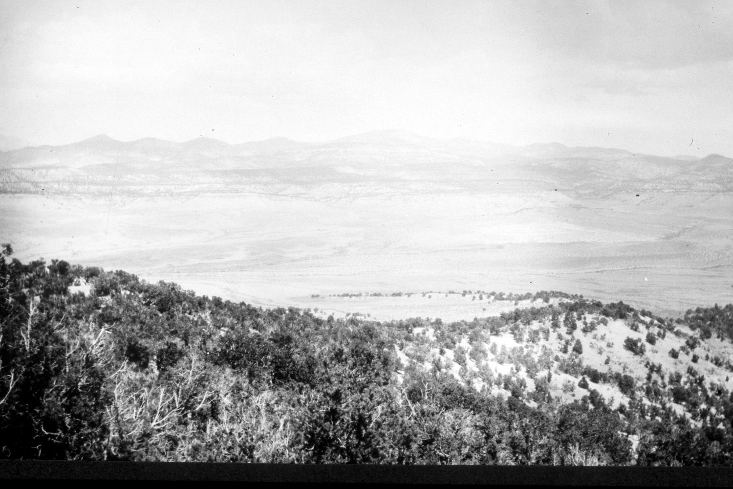
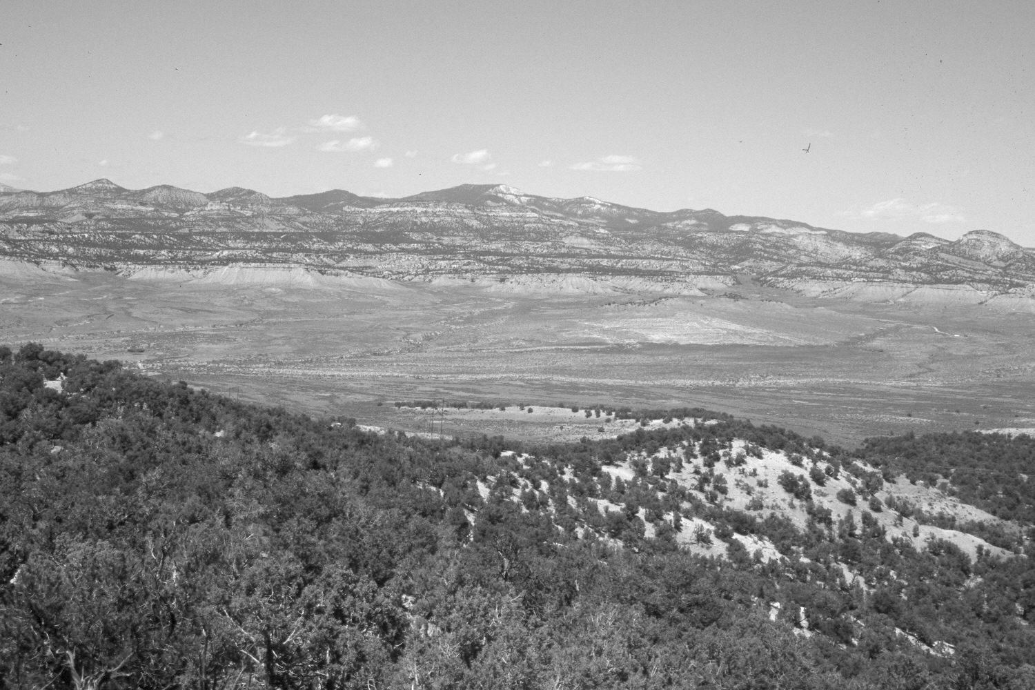
Plate 434X. Round Point 1921 – 2004 Viewed north from Round Point across Round Valley to Canaan Peak (9,293 ft.). The original camera station is now blocked by woody vegetation, so the retake was made from the nearest open area. Pinyon and juniper have increased. Note the high voltage powerline in the retake, as well as the new access roads.
Photo Information:
Original photograph taken by R.C. Moore (No. 146) in 1921; retake by Charles E. Kay on May 13, 2004 - - Photo No. 5302-22. . Original photograph held by the U.S. Geological Survey Photographic Library, Denver, CO.
Vegetative Community:
Pinyon, Juniper
Location:
South West: Section 26, Range 1 West, Township 38 South; UTM 422850 E, 4147600 N; elevation 6,922 ft
January 2018