Round Point
1921
2004
Description:
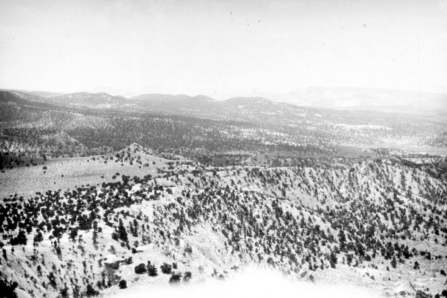
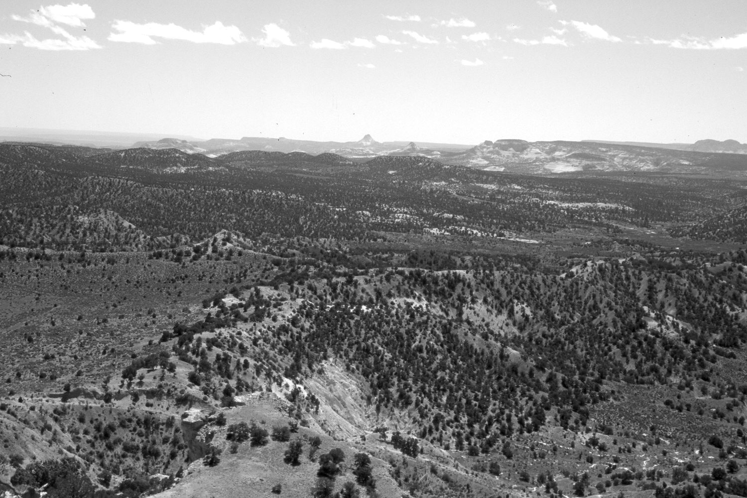
Plate 433X. Round Point 1921 – 2004 Viewed southwest from Round Point. Round Valley Draw is on the right. Note the old road in the retake - - the new road is out-of-sight at the base of Round Point. Pinyon and juniper have increased. The open area on the left has been root-plowed and reseeded with crested wheatgrass. The most common shrubs are Wyoming big sage, four-wing saltbrush, rubber rabbitbrush, and greasewood on the flatter areas, while cliff rose and silverberry are found on the steeper slopes.
Photo Information:
Original photograph taken by R.C. Moore (No. 153) in 1921; retake by Charles E. Kay on May 13, 2004 - - Photo No. 5302-19. Original photograph held by the U.S. Geological Survey Photographic Library, Denver, CO.
Vegetative Community:
Pinyon, Juniper, Sagebrush
Location:
South West: Section 26, Range 1 West, Township 38 South; UTM 422850 E, 4147600 N; elevation 6,922 ft.