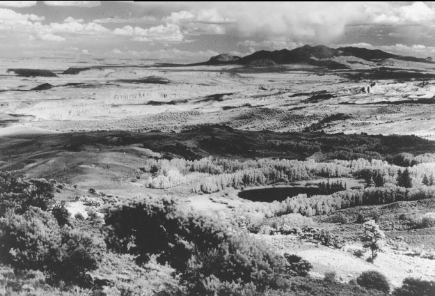
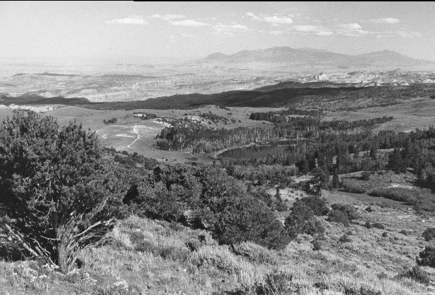
Round Lake
1940
1999
Description:
Plate 96. ROUND LAKE: ca. 1940 - 1999 LOCATION: NOTE: Capitol Reef National Park and the Henry Mountains are in the distance. A dam built at the lake’s outlet sometime after 1940 increased the size of the lake and eliminated the shoreline willows prior to 1999. Aspen (Populus tremuloides) increased in height between 1940 and 1999, but most stands have failed to regenerate. Ponderosa pine (Pinus ponderosa) and Douglas-fir (Pseudotsuga menziesii) at photo right-center have increased by 1999, as have pinyon (Pinus edulis) and juniper (Juniperus sp.) throughout the photo. A 4x4 road is visible on the hill to the left of Round Lake in the 1999 photo. The perspective of the two photos is slightly different because the 1940 photo was apparently taken with a telephoto lens while the 1999 photo was taken with a normal lens.
Photo Information:
1940 photo is held by the Utah Historical Society [#551.43 – 1879], Salt Lake City, UT; 1999 photo is Kay #4470-22, taken on Aug. 12.
Vegetative Community:
Riparian, Aspen, Conifer, Pinyon, Juniper, Sagebrush
Location:
South Central: Thousand Lake Mountain, Fishlake National Forest, Loa Ranger District, T26S, R4E, Sect. 35, UTM 4261350 N, 460650 E; elevation 9,240 ft., viewed to southeast.