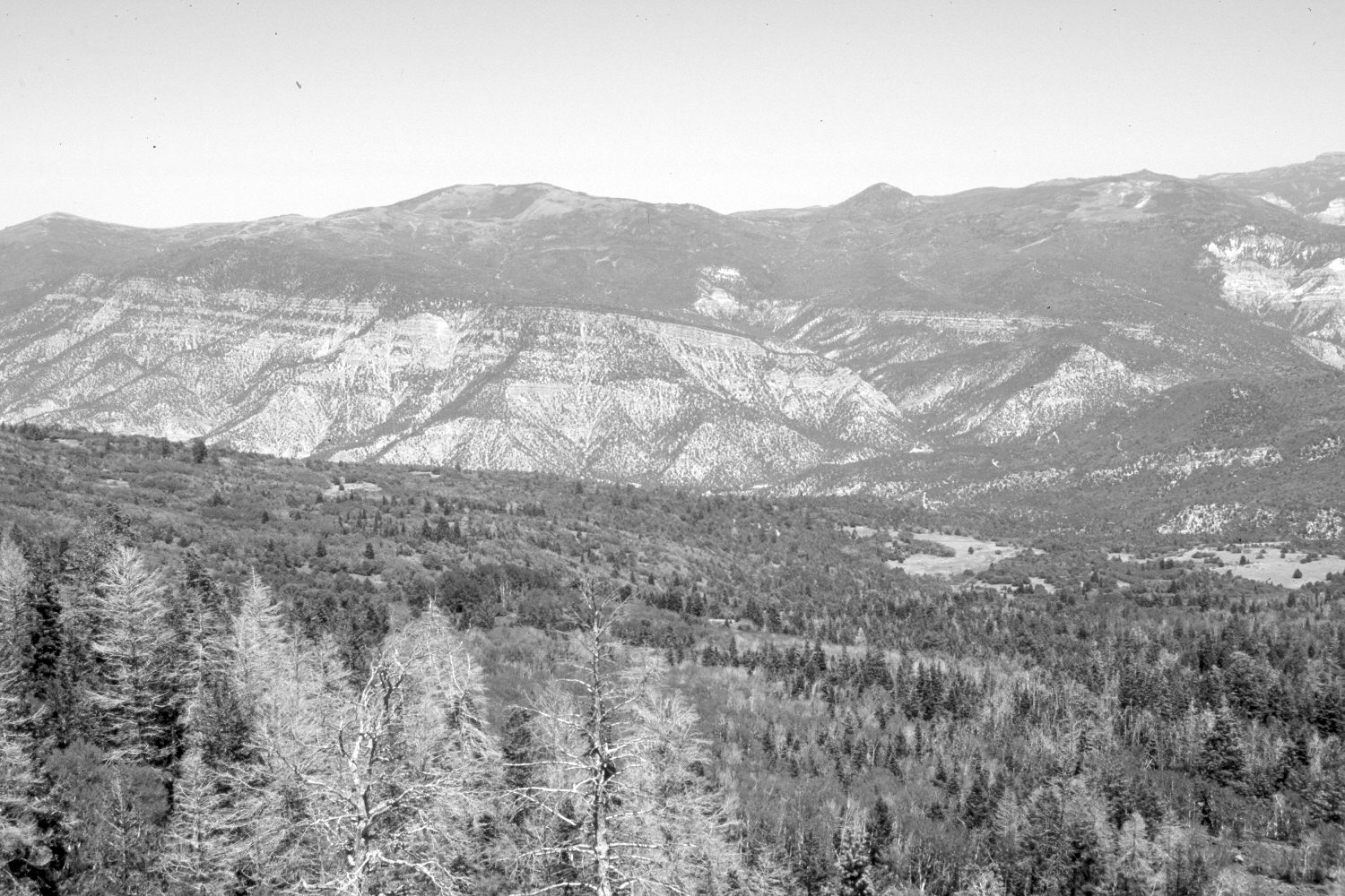
Right Hand Creek
1937

2006
Description:
Plate 1334X. Right Hand Creek 1937 – 2006 Viewed north-northeast down Right Hand Creek to Cedar Canyon from the southeast end of Lone Tree Mountain above Cedar City. On the skyline from left to right are Windy Ridge (9,549 ft), Eagle Peak (9,858 ft), Sugarloaf Mountain (9,998 ft), and Brian Head (11,307 ft). White fir, Douglas fir, spruce, ponderosa pine, pinyon, juniper, oakbrush, and other mountain brush species have all increased, while aspen has declined. Forest fuels have increased.
Photo Information:
U.S. Forest Service photograph (unnumbered) taken by R.C. Pragnell on November 19, 1937; retake by Charles E. Kay on July 15, 2006 - - Photo No. 5693-20. Original photograph held by Southern Utah University Archives and Special Collections, Cedar City, UT.
Vegetative Community:
Conifer, Pinyon, Juniper, Mountain Brush, Aspen
Location:
South West: Section 36, Range 11 West, Township 36 South; UTM 321130 E, 4165630 N; elevation 9,100 ft.