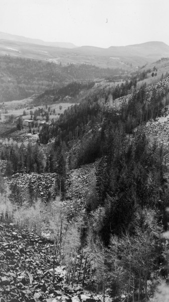
Right Hand Creek
1937
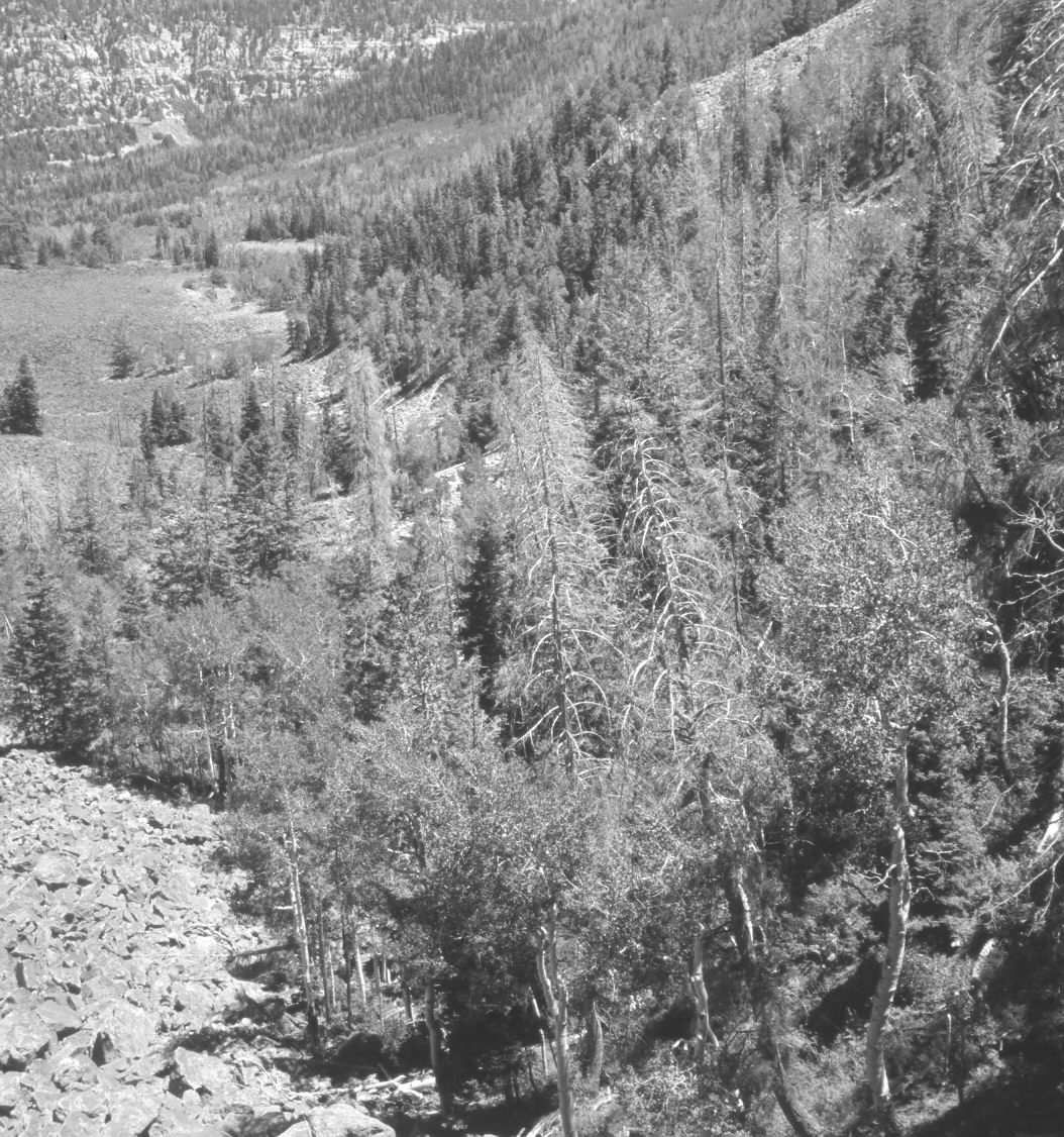
2006
Description:
Plate 1333X. Right Hand Creek 1937 – 2006 Viewed east-southeast up Right Hand Creek from the southeast end of Lone Tree Mountain above Cedar City. Blowhard Mountain (10,596 ft) is on the left and Black Mountain (10,400 ft) on the right skyline. Conifers have increased, while aspen has declined.
Photo Information:
U.S. Forest Service photograph (unnumbered) taken by R.C. Pragnell on November 19, 1937; retake by Charles E. Kay on July 15, 2006 - - Photo No. 5693-15. Original photograph held by Southern Utah University Archives and Special Collections, Cedar City, UT.
Vegetative Community:
Conifer, Aspen
Location:
South West: Section 36, Range 11 West, Township 36 South; UTM 321200 E, 4165600 N; elevation 9,080 ft.
January 2018