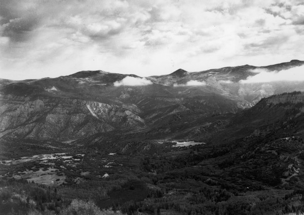
Right Hand Creek
1941
2006
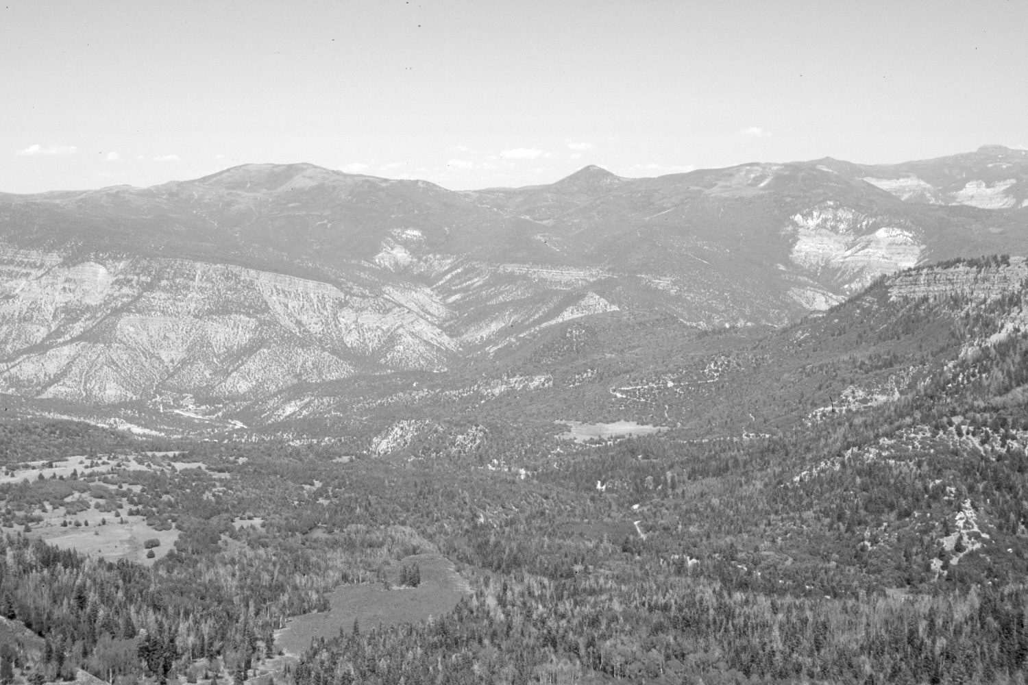
Description:
Plate 1320X. Right Hand Creek 1941 – 2006 Viewed northeast down Right Hand Creek to Coal Creek from Cedar Mountain. Eagle Peak (9,917 ft) is on the left, Sugarloaf Mountain (9,998 ft) in the center, and Brian Head (10,307 ft) on the far right. Pinyon, juniper, Douglas fir, spruce, white fir, ponderosa pine, oakbrush, and mountain brush have all increased, while aspen has declined.
Photo Information:
Original photograph taken by Gregory (No. 1080) in 1941; retake by Charles E. Kay on July 12, 2006 - - Photo No. 5686-31. Original photograph held by the U.S. Geological Survey Photographic Library, Denver, CO.
Vegetative Community:
Pinyon, Juniper, Conifer, Mountain Brush, Aspen
Location:
South West: Section 6, Range 10 West, Township 37 South; UTM 322150 E, 4164700 N; elevation 9,160 ft.