Right Fork Of Blubber Creek
1964
2003
Description:
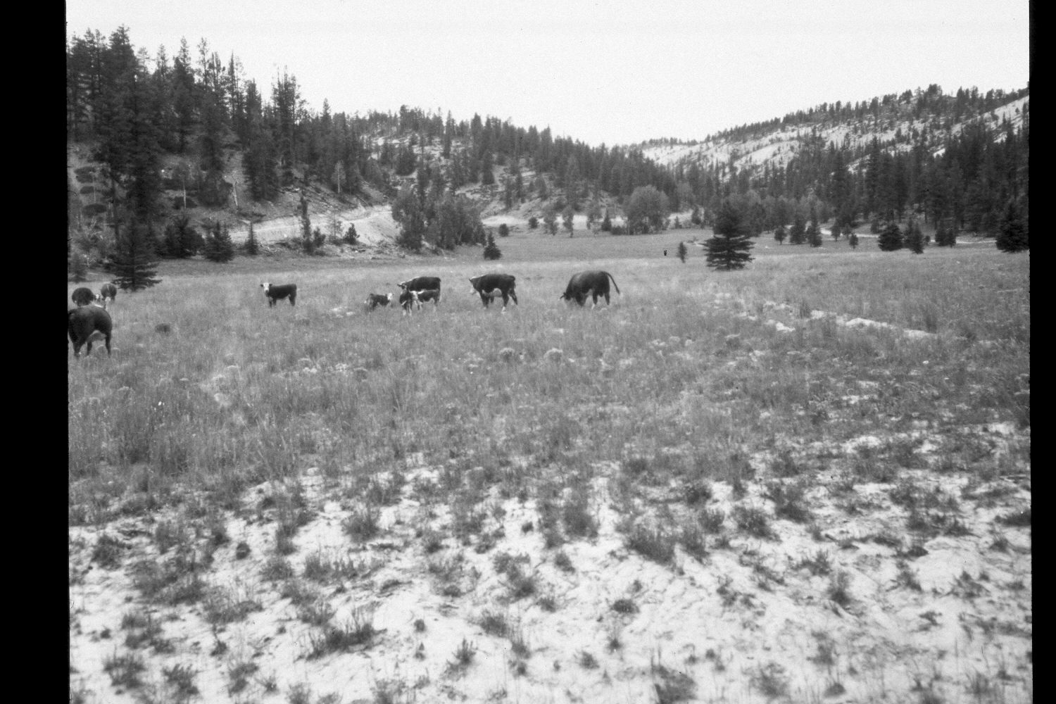
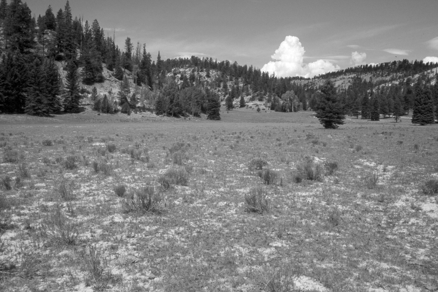
Plate 287X. Right Fork of Blubber Creek 1964 - 2003 Viewed northwest up the Right Fork of Blubber Creek on the Paunsaugunt Plateau. The area was actively being logged when the original image was made. The road visible on the left in the earlier image has since been abandoned and revegetated. The meadow had been reseeded prior to 1964 and today is mostly intermediate wheatgrass. Despite logging, ponderosa pine, spruce, and juniper have all increased, while aspen has declined - - except for one clone (photo left center), which regenerated during the early 1970s when mule deer numbers were low (Kay and Bartos 2000). Those aspen saplings, however, have now been highlined and all aspen suckers repeatedly browsed by wildlife and livestock. The shrubs in the meadow are mostly rubber rabbitbrush. The area had not been grazed by cattle in 2003 when this camera station was revisited.
Photo Information:
U.S. Forest Service photograph (unnumbered) taken by G. Glad Quilter in 1964; retake by Charles E. Kay on August 7, 2003 - - Print from color slide. Original photograph held in the range files on the Panguitch Ranger District, Dixie National Forest, Panguitch, UT.
Vegetative Community:
Dry Meadow, Conifer, Juniper, Aspen
Location:
South West: Section 27, Range 4½ West, Township 37 South; UTM 384150E, 4157300 N; elevation 8,260 ft.