Richie Flat
1960
2004
Description:
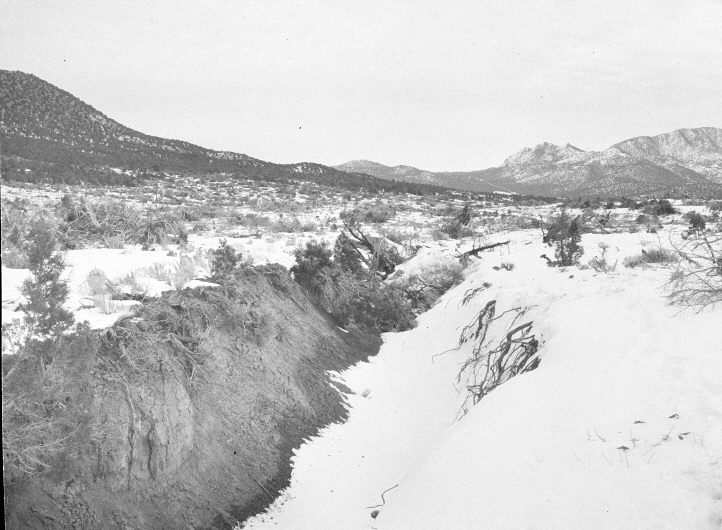
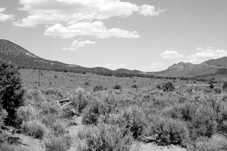
Plate 667X. Richie Flat 1960 – 2004 Viewed northeast along upper Richie Flat above Little Pinto Creek. The original photograph was taken shortly after the area had been chained and reseeded with crested wheatgrass. Sagebrush has increased as have pinyon and juniper. A new powerline has been constructed. Gully erosion has ceased.
Photo Information:
U.S. Forest Service photograph (unnumbered) taken ca. 1960; retake by Darrell McMahon on June 1, 2004 - - Photo No. DM-11-32A. Original photograph held by Southern Utah University Archives and Special Collections, Cedar City, UT.
Vegetative Community:
Dry Meadow, Pinyon, Juniper, Sagebrush
Location:
South West: Section 30, Range 14 West, Township 37 South; UTM 232325 E, 4159500 N; elevation 6,316 ft.
January 2018