Red Canyon Wash
1936
2003
Description:
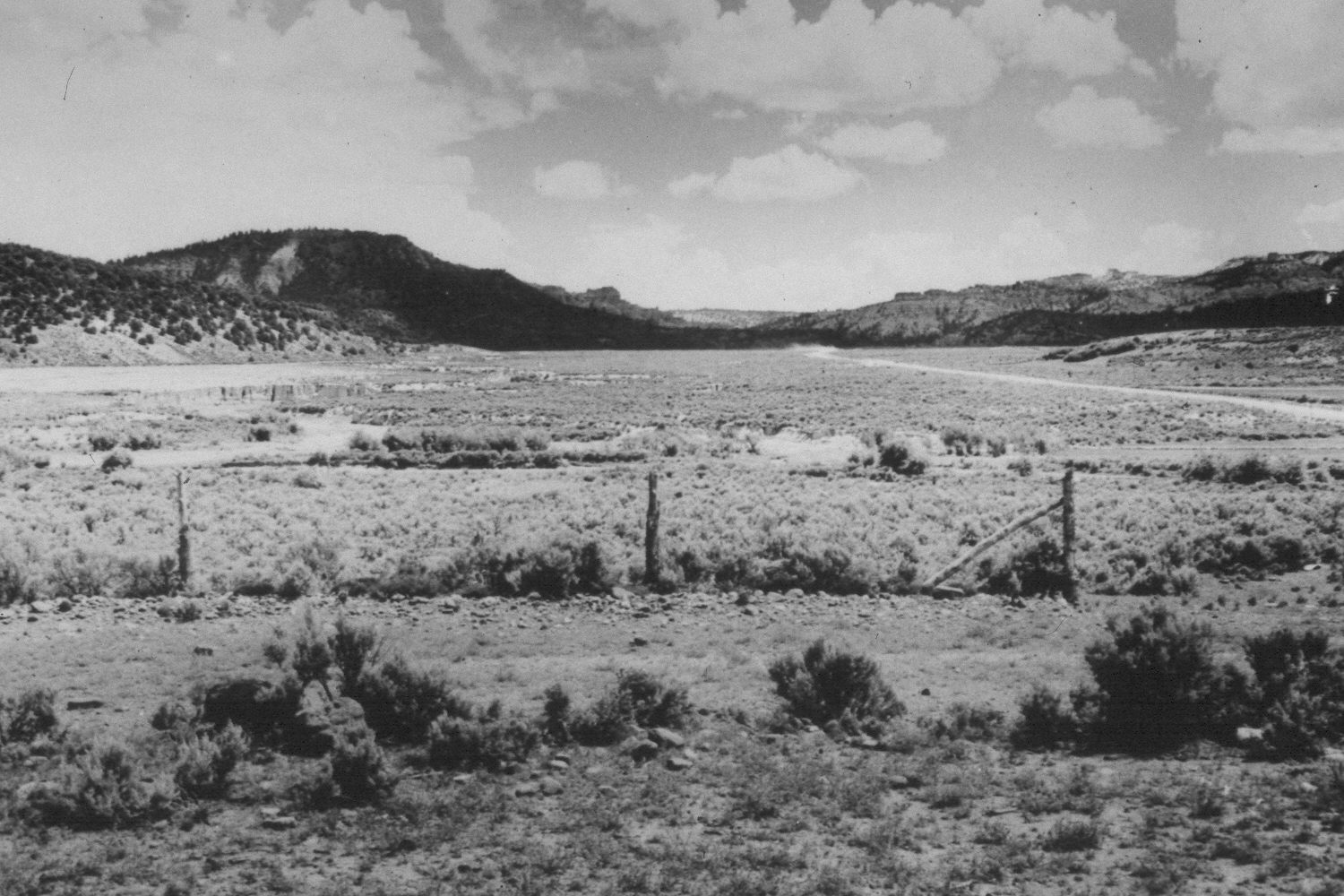
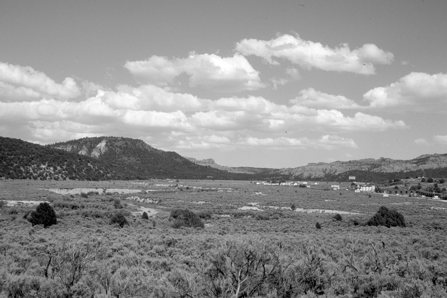
Plate 142X. Red Canyon Wash 1936-2003 Viewed east up Red Canyon Wash at its confluence with the Sevier River, which flows from right to left. Utah Highway 12 is on the right and it has been widened and paved since the initial image. Various motels and stores have been built along Highway 12 to service tourists traveling to Bryce Canyon National Park. Pinyon and juniper have increased as has sagebrush, especially in the foreground. The bottom of Red Canyon Wash appears more vegetated today than it did in 1936. The few willows along the lower portion of Red Canyon Wash and this section of the Sevier River appear unchanged.
Photo Information:
U.S. Forest Service photograph (378427) taken by A.R.C. in July 1936; retake by Charles E. Kay on June 23, 2003 - - Photo No. 5169-29. Original photograph held by Utah Historical Society, Reed W. Bailey Collection, Salt Lake City, UT
Vegetative Community:
Pinyon, Juniper, Sagebrush, Riparian
Location:
South West: Section 24, Range 5 West, Township 35 South; UTM 378800 E, 4178750 N; elevation 6,760 ft.