Red Canyon
1964
2003
Description:
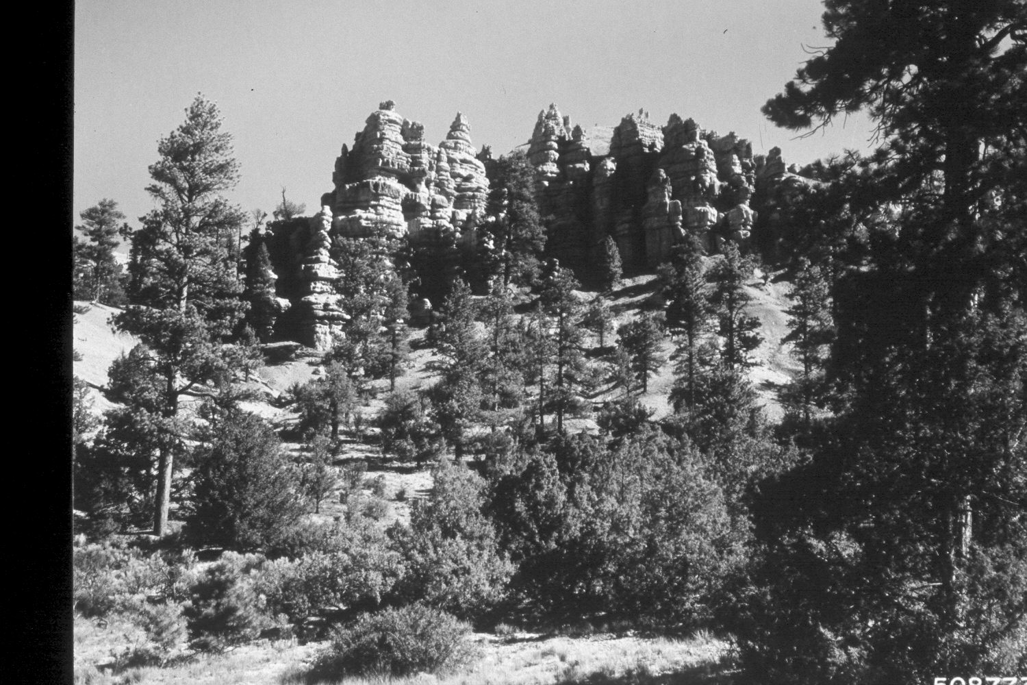
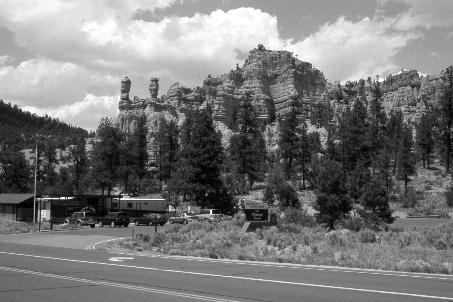
Plate 136X. Red Canyon 1964-2003 Viewed northwest to the balanced rocks in Red Canyon. This photoset is similar to Plate 134x. Conifers, primarily ponderosa pine, spruce, and juniper appear to have increased. Utah Highway 12 has been realigned and the Forest Service has built a new parking lot and visitor center.
Photo Information:
U.S. Forest Service photograph (508774) taken by Prater in August 1964; retake by Charles E. Kay on June 23, 2003 - - Photo No. 5166-21. Original photograph held by U.S. Forest Service Regional Office Photographic Collection (Dixie-2360-1) housed at Weber State University, Ogden, UT.
Vegetative Community:
Conifer, Juniper
Location:
South West: Section 27, Range 4½ West, Township 35 South; UTM 384200 E, 4178000 N; elevation 7,220 ft.
January 2018