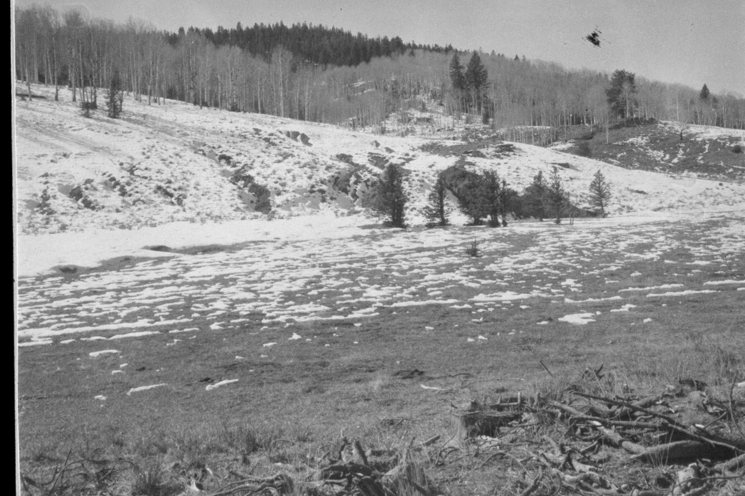
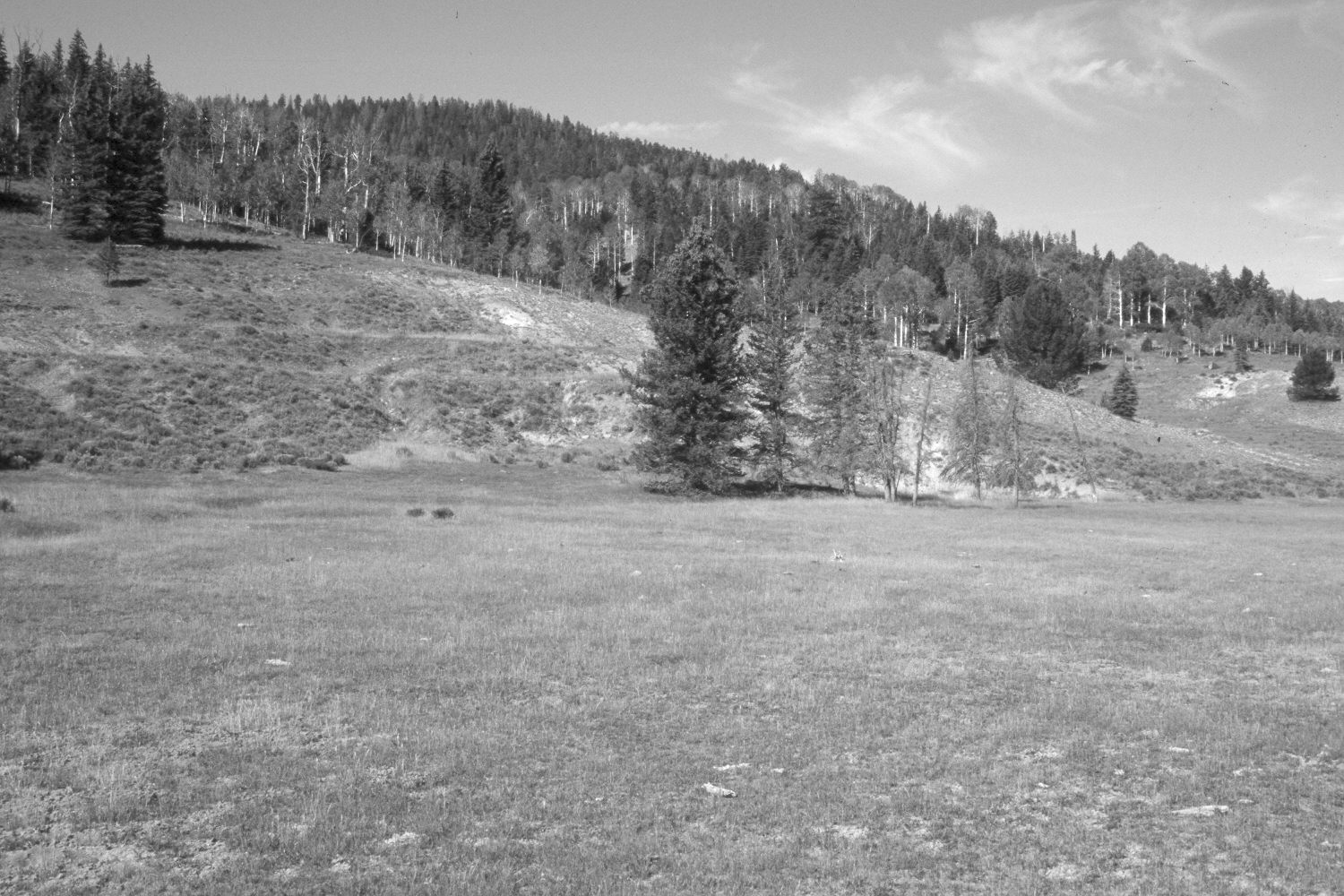
Podunk Creek
1959
2003
Description:
Plate 241X. Podunk Creek 1959 - 2003 Viewed west-southwest across Podunk Creek. Spruce, white fir (Abies concolor), Douglas fir, and limber pine have all increased, while aspen has declined. A few aspen stands regenerated about 25 years ago when mule dder populations were low (Kay and Bartos 2000), but now all aspen suckers are been repeatedly browsed by cattle, deer, and elk. The meadow is mostly smooth brome and Kentucky bluegrass. The shrubs on the near hillside are rubber rabbitbrush. The near hillside has been contour-trenched and reseeded by the Forest Service to control erosion. Retakes were also made from this same camera station by the Forest Service in 1988 and 2000.
Photo Information:
U.S. Forest Service photograph (unnumbered) taken in the spring of 1959; retake by Charles E. Kay on August 6, 2003 - - Photo No. 5218-8A. Original photograph held in the range files on the Panguitch Range District, Dixie National Forest, Panguitch, UT.
Vegetative Community:
Conifer, Aspen, Dry Meadow
Location:
South West: Section 24, Range 4 ½ West, Township 38 South; UTM 387100E, 4149450N; elevation 8,140 ft.