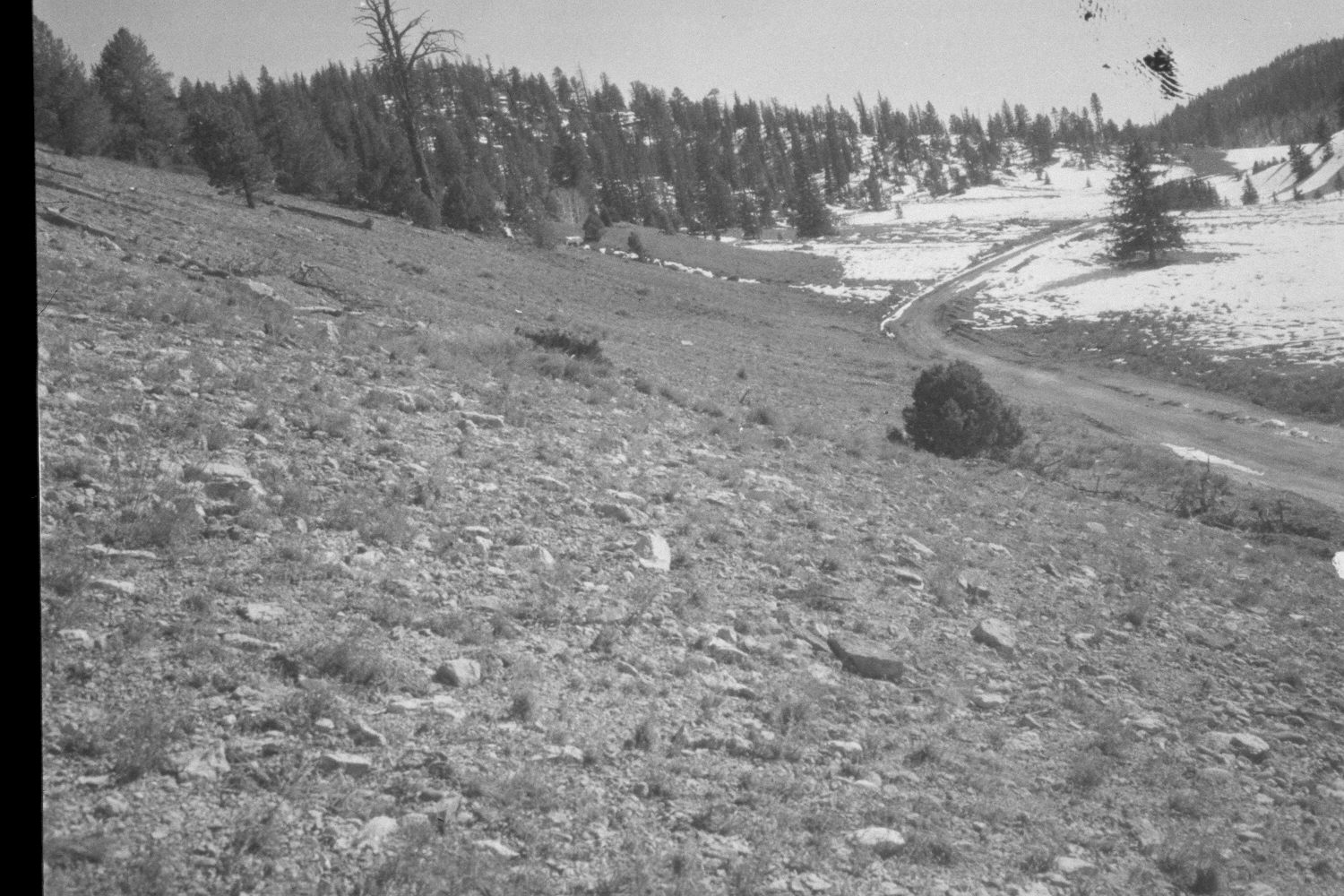
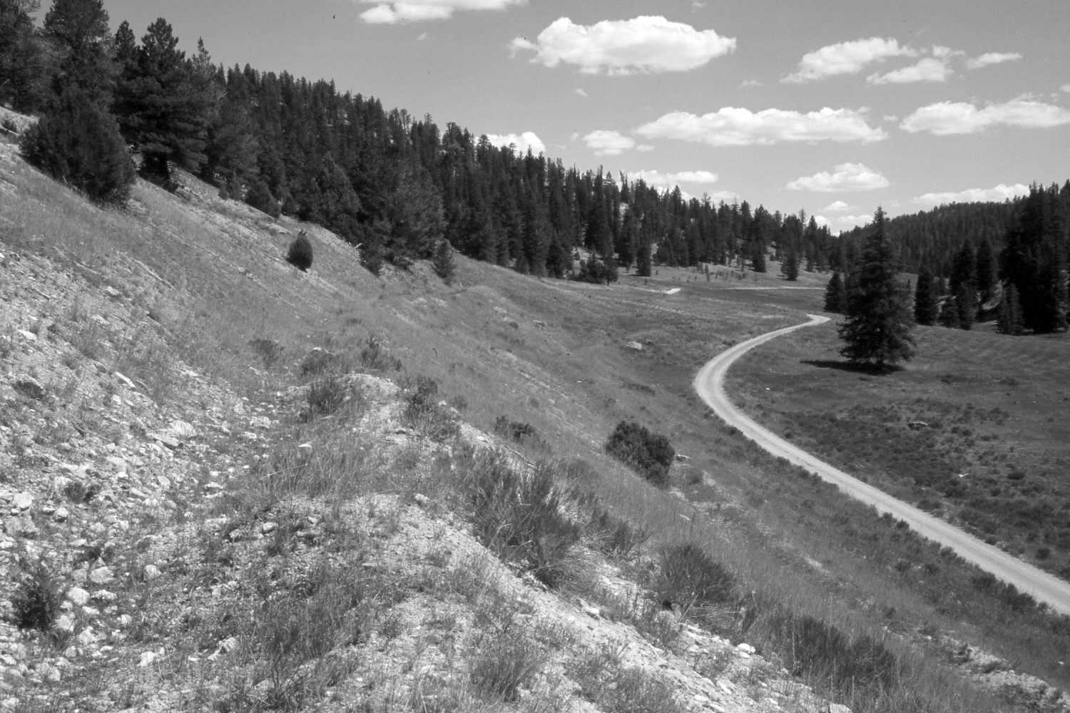
Podunk Creek
1959
2003
Description:
Plate 243X. Podunk Creek 1959 - 2003 Viewed southeast up Podunk Creek. The original photograph was taken before the area was contour-trenched and reseeded to control erosion. Juniper, spruce, and ponderosa pine have all increased. The shrubs are mostly rubber rabbitbrush. The seeded grasses are primarily smooth brome and intermediate wheatgrass. Retakes were also made from the same camera station by the Forest Service in 1988 and 2000.
Photo Information:
U.S. Forest Service photograph (unnumbered) taken in the spring of 1959; retake by Charles E. Kay on August 4, 2003 - - Photo No. 5208-27. Original photograph held in the range files on the Panguitch Range District, Dixie National Forest, Panguitch, UT.
Vegetative Community:
Juniper, Conifer, Dry Meadow
Location:
South West: Section 24, Range 4 ½ West, Township 38 South; UTM 387130E, 4149450N; elevation 8,130 ft.