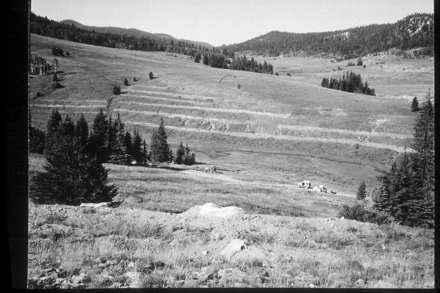
Podunk Creek
1961
2003
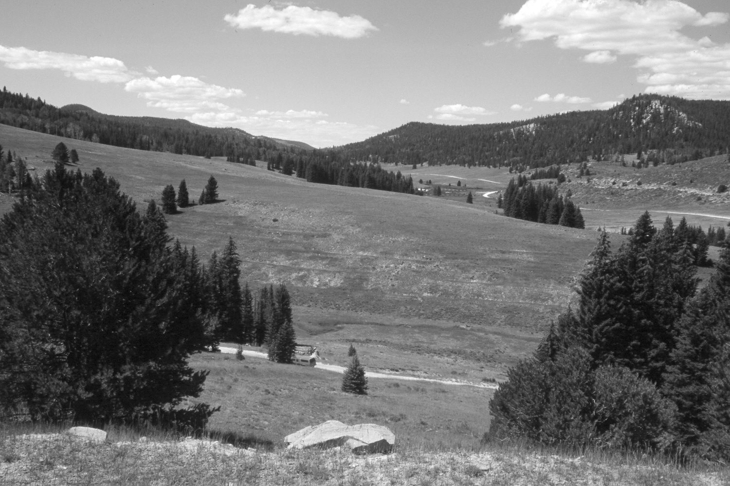
Description:
Plate 234X. Podunk Creek 1961 - 2003 Viewed southwest across lower Podunk Creek and up the East Fork of the Sevier River. The original image was made as the area was being contour-trenched and reseeded to control erosion. Conifers, primarily spruce, have increased, while aspen has declined. Willows in the distance appear to have increased - - they are located just upstream from the Podunk Guard Station. A limber pine has become established in the left foreground, while a pinyon pine has grown-up on the right. Retakes were also made from this camera station by the Forest Service in 1988 and 2000.
Photo Information:
U.S. Forest Service photograph (unnumbered) taken in 1961; retake by Charles E. Kay on August 4, 2003 - - Photo No. 5206-20A. Original photograph held in the range files on the Panguitch Ranger District, Dixie National Forest, Panguitch, UT and Southern Utah University Archives and Special Collections, Cedar City, UT.
Vegetative Community:
Conifer, Aspen, Riparian, Pinyon
Location:
South West: Section 12, Range 4 ½ West, Township 38 South; UTM 386200E, 4150350N; elevation 8,240 ft.