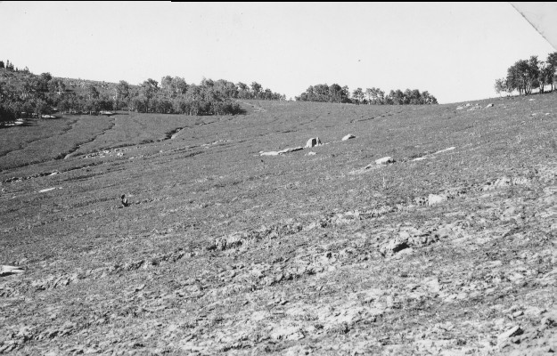
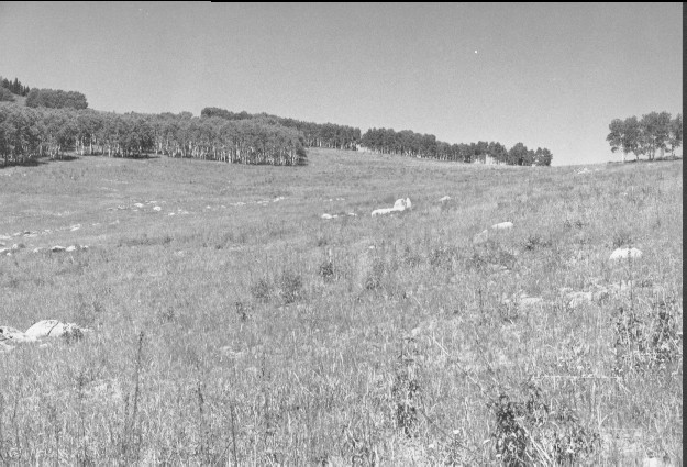
Pioneer Peak
1945
1999
Description:
Plate 120 PIONEER PEAK: 1945 - 1999 This photo set is similar to Plate 119 except the camera station is approximately 150 feet west and the view is more to the north. The site was very heavily grazed, with active soil erosion and gullying in 1945. The area was contour trenched, gully-plugged, and reseeded by the Forest Service sometime later to stop the erosion and improve range conditions. Aspen (Populus tremuloides) had regenerated shortly before the 1945 photo was taken, but there is no evidence of additional regeneration since. There are no conifers in these aspen stands. The seeded grasses are primarily smooth brome (Bromus inermis) and intermediate wheatgrass (Agropyron intermedium). Tall larkspur (Delphinium sp.) is common in the 1999 photo.
Photo Information:
1945 photo taken on Oct. 4 by the U.S. Forest Service; 1999 photo is Kay #4476-31, taken on Sept. 4. Forest Service photo [2500A-113-Erosion Effects] held by Fillmore Ranger District, Fishlake National Forest, Fillmore, UT
Vegetative Community:
Aspen, Dry Meadow
Location:
South Central: North Fork of Chalk Creek, Fishlake National Forest, Fillmore Ranger District; T21S, R3W, Sect. 14, UTM 4316410 N, 399175 E; elevation 9,600 ft., viewed to north-northwest.