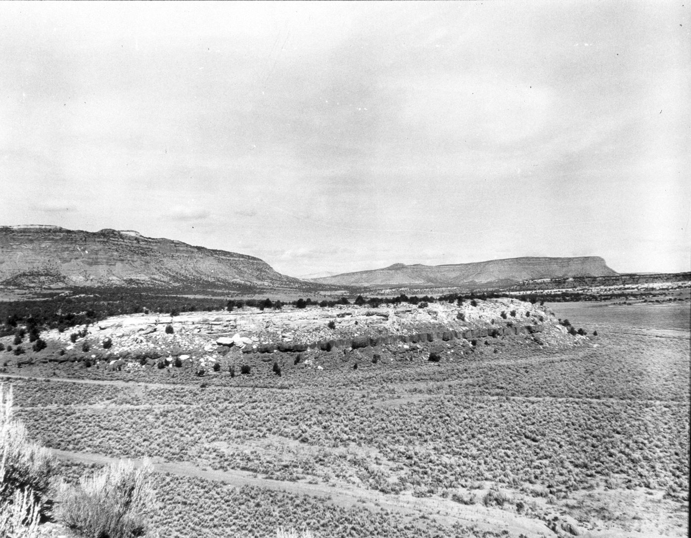
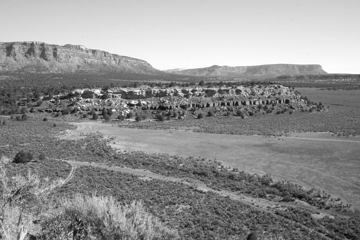
Pioneer Gap
1944
2004
Description:
Plate 479X. Pioneer Gap 1944 – 2004 Viewed northeast at Pioneer Gap with the Vermilion Cliffs in the distance. The area in the foreground is private and a new field has been cleared. Wyoming big sage is the most common shrub, but some plants have died during the recent drought. Pinyon and juniper have increased in the distance.
Photo Information:
Original photograph taken by H.E. Gregory (No. 1227) in 1944; retake by Charles E. Kay on June 7, 2004 - - Photo No. 5332-20. Original photograph held in the U.S. Geological Survey Photograph Library, Denver, CO.
Vegetative Community:
Pinyon, Juniper, Sagebrush
Location:
South West: Section 32, Range 4 West, Township 43 South; UTM 388500 E, 4098700 N; elevation 5,420 ft.
January 2018