Pine Hills
1917
2002
Description:
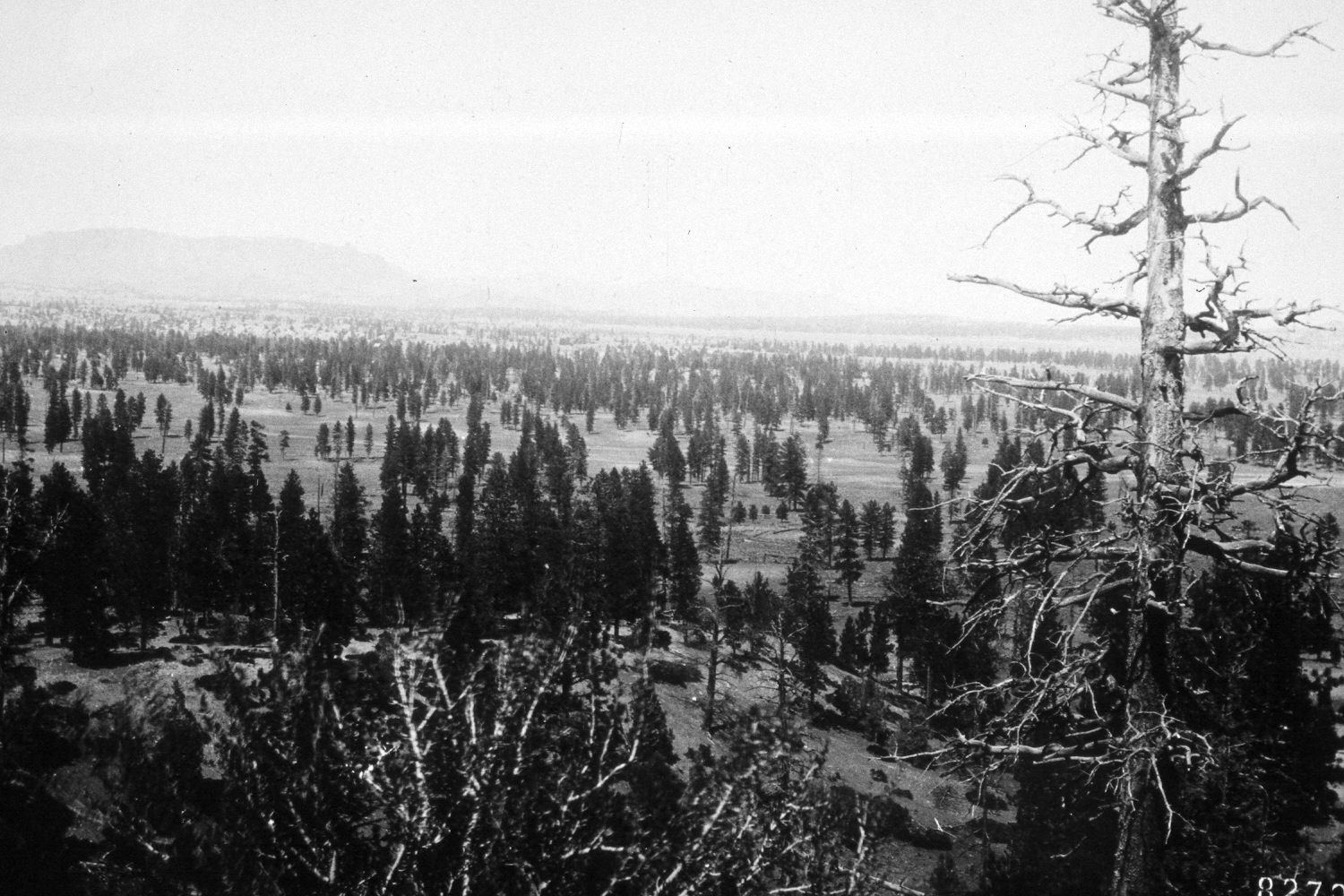
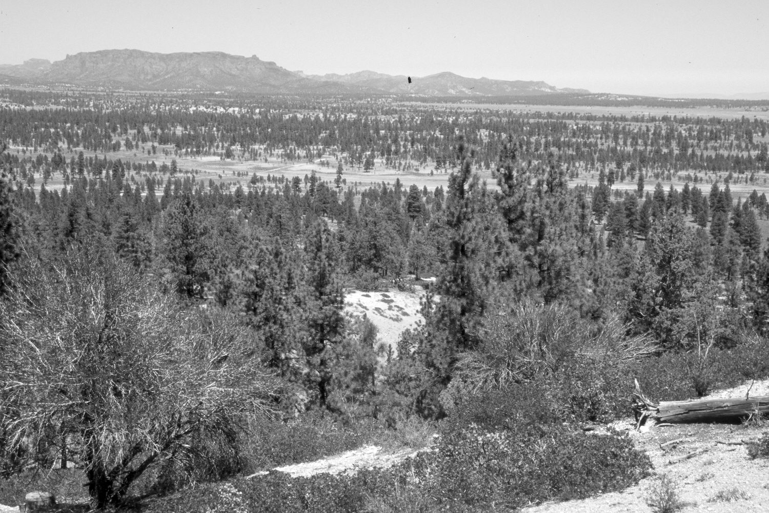
Plate 119X. Pine Hills 1911-2002 Viewed north to Flat Top (9,374 ft.) from East Pine Hill northwest of Bryce Junction. Shrubs and conifers now block the original photopoint, so the retake was made from the nearest open area. The tall shrubs in the foreground are curlleaf mountain mahogany, while the low, evergreen shrubs are green manzanita. Ponderosa pine has increased despite repeated, selective logging. Much of the area in the valley has also been prescribe-burned by the Forest Service to reduce forest in-growth. Note how few young trees there were in the original image compared to conditions today. Clearly, these pine forests were once swept by repeated, low-intensity ground fires that limited pine regeneration and promoted the growth of grasses and forbs. Much of Flat Top and adjacent areas was burned earlier in 2002 by an escaped, prescribed fire initially set by the Forest Service. A few pinyon and juniper are scattered throughout the pine forest.
Photo Information:
U.S. Forest Service photograph 82708 taken by L. Crowell on April 17, 1911; retake by Charles E. Kay on August 9, 2002 - - Photo No. 5026-4A. Original photograph held by the U.S. Forest Service Regional Photographic Collection (4110-Dixie-9) housed at Weber State University, Ogden, UT.
Vegetative Community:
Mountain Brush, Conifer, Pinyon, Juniper
Location:
South West: Section 36, Range 4 West, Township 35 South; UTM 396500E, 4174150N; elevation 7,850 ft.