Phonolite Hill
1872
2003
Description:
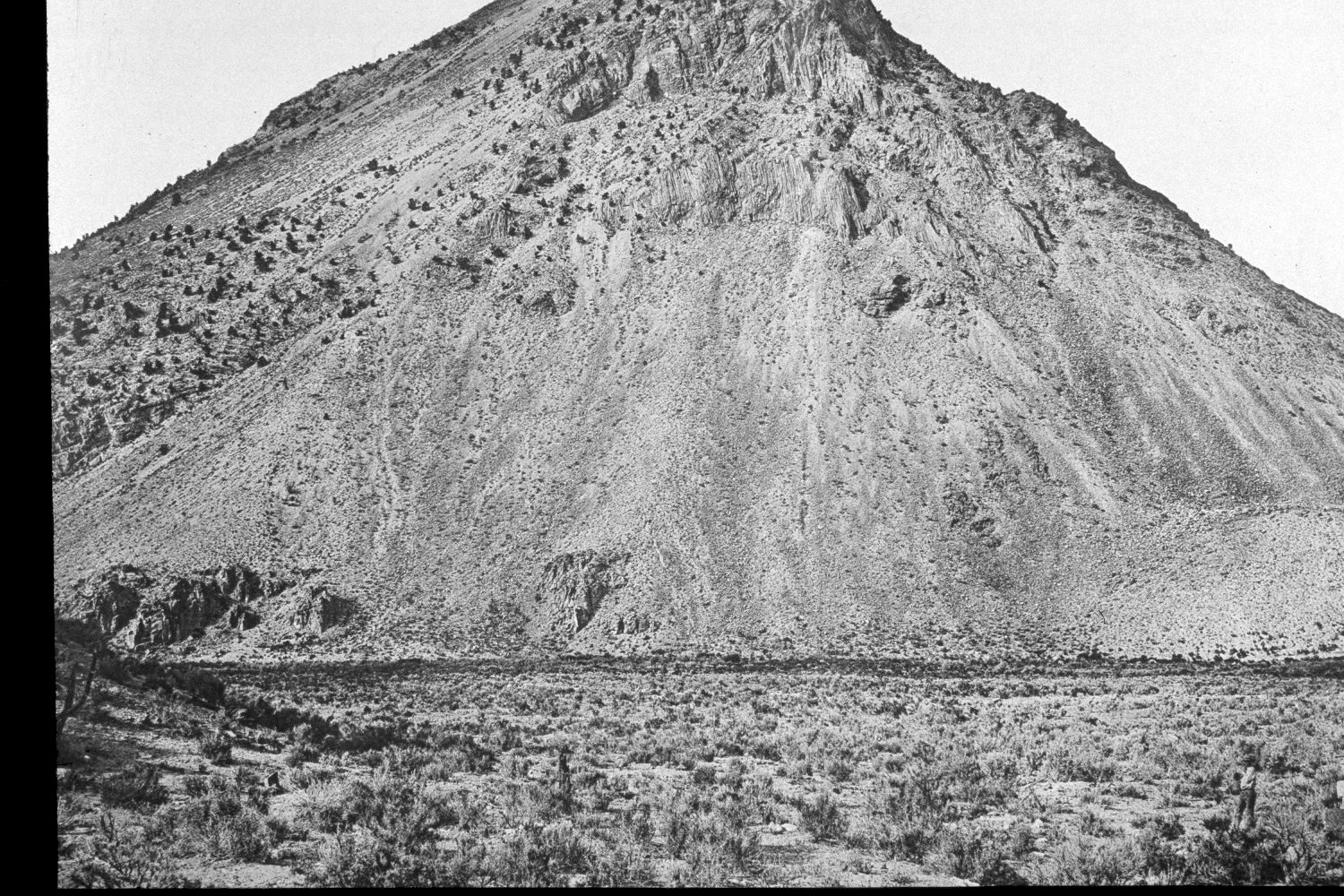
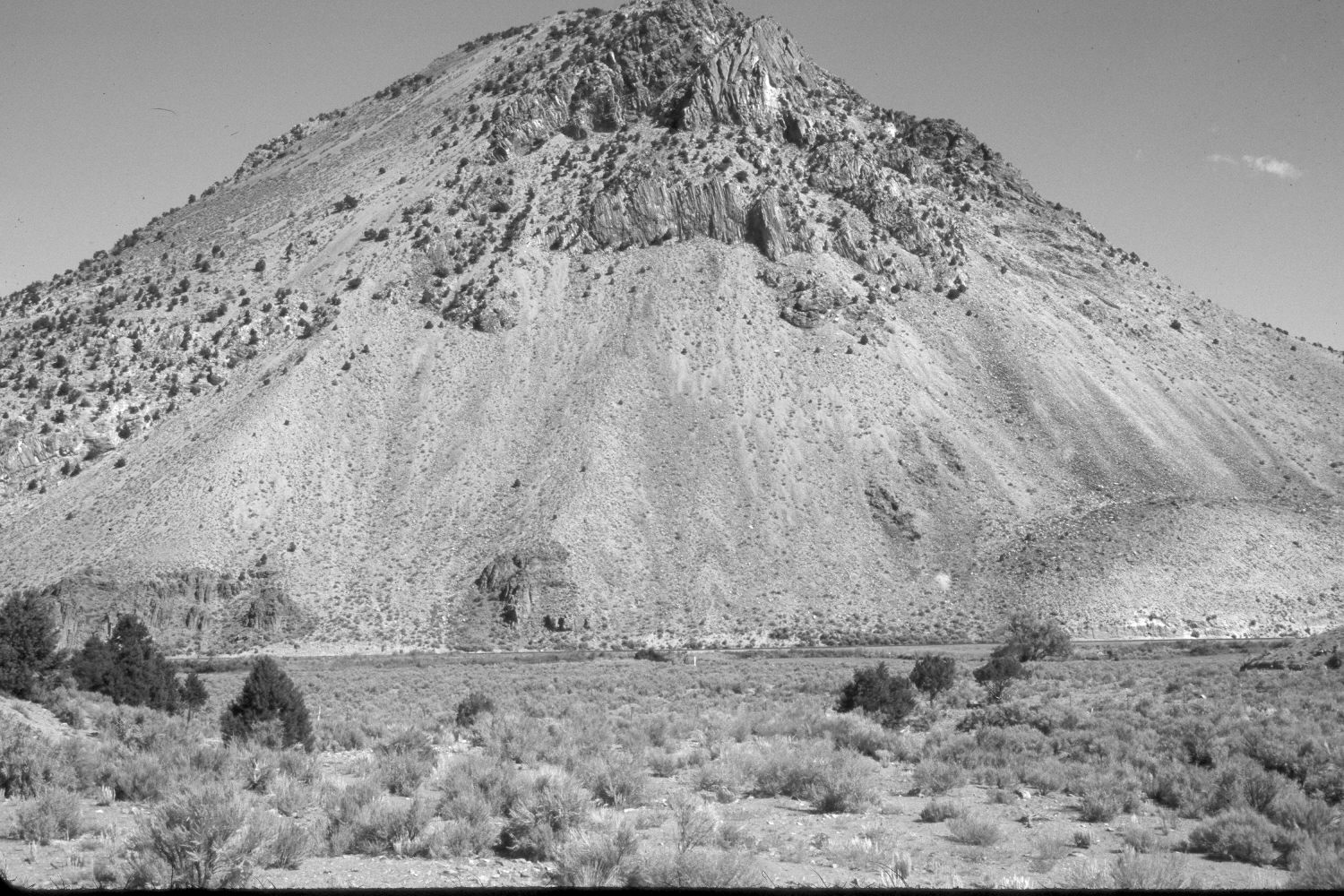
Plate 397X. Phonolite Hill Kingston Canyon 1872- 2003 Viewed northeast to Phonolite Hill in the upper end of Kingston Canyon. Utah Highway 62 is at the base of the cliffs and the East Fork of the Sevier River is just below the highway. Note the person and wagon in the lower right corner of the 1872 image - - today there is a gully in that area. The vegetation in the foreground is mostly sagebrush, rubber rabbitbrush, greasewood, four-wing saltbrush (Atriplex canescens), and winter fat (Eurotia or Ceratoides lanata). Pinyon and juniper have increased in the foreground, but show little change on the dry, south-facing exposures of Phonolite Hill. The area in the foreground is BLM and was heavily grazed by cattle in 2003. The area between the fence and Utah Highway 62 is private. This section of the East Fork supported very little woody riparian vegetation in 1872. Today, there are a few willows and at least one box elder tree along the river. All in all, though, there has been very little change in 131 years.
Photo Information:
U.S. Geological Survey Photograph taken by John Hillers in 1872; retake by Charles E. Kay on October 1, 2003 - - Photo No. 5281-12. The original photograph is not in the National Archives nor in the USGS Photographic Library, but instead is Heliotype XI in C.E. Dutton’s 1880 Report on the geology of the high plateaus of Utah, Government Printing Office, Washington D.C. 307 pp.
Vegetative Community:
Sagebrush, Pinyon, Juniper, Riparian
Location:
South West: Section 23, Range 2½ West, Township 30 South; UTM 404400 E, 4226350 N; elevation 6,400 ft.