Paria River - Promise Rock
1939
2004
Description:
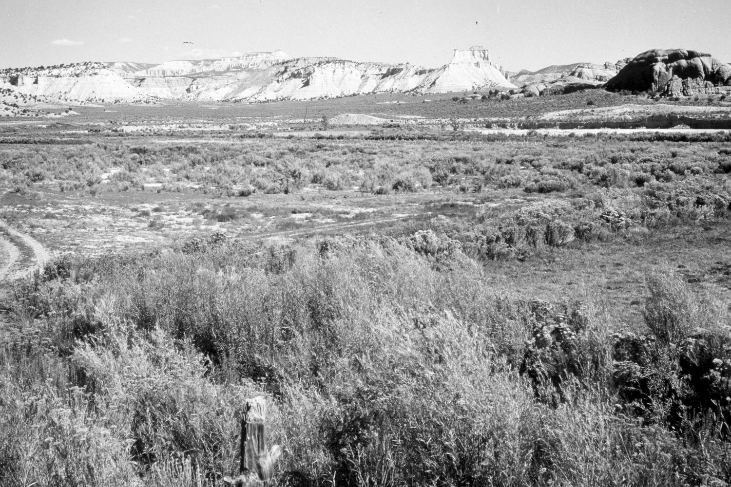
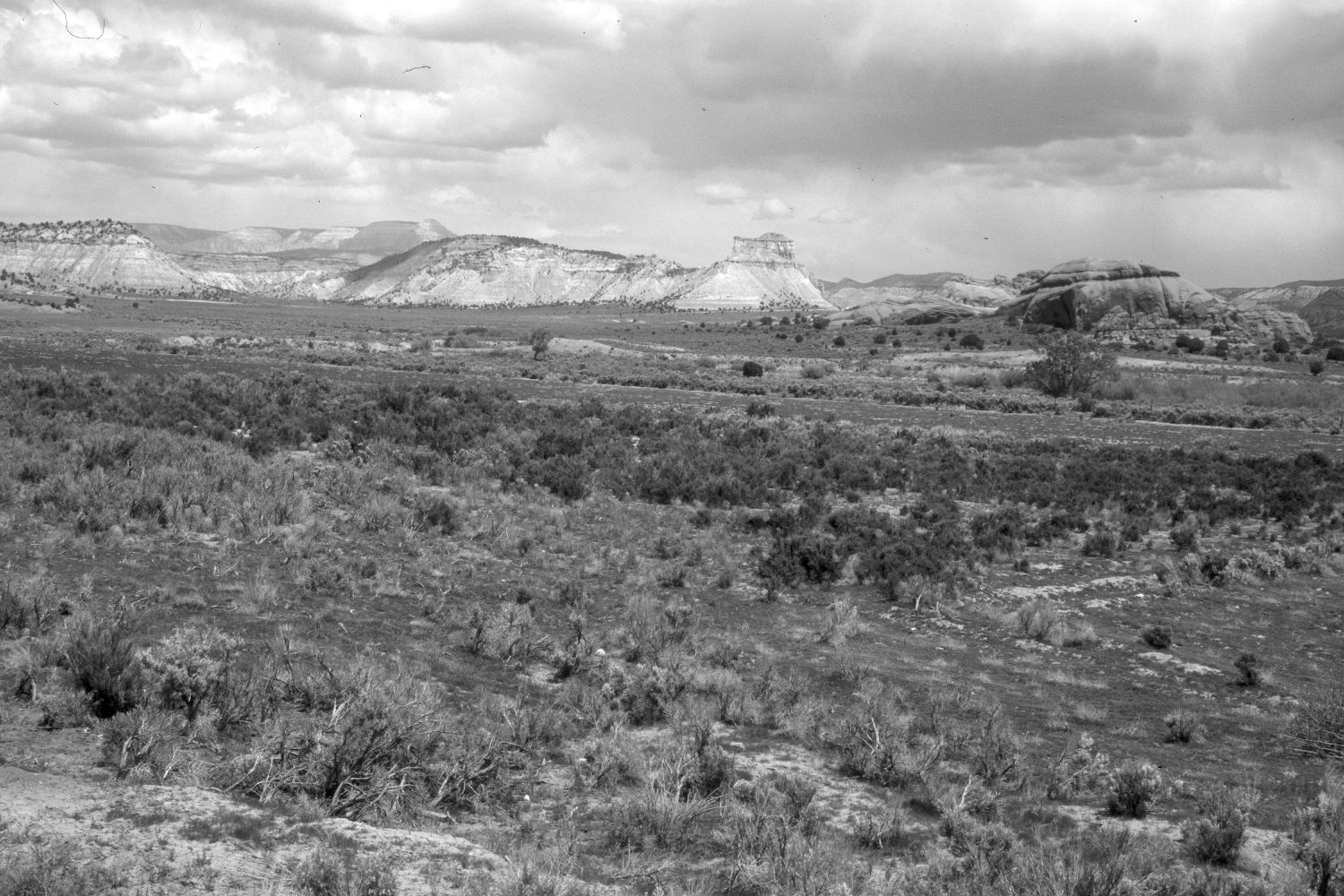
Plate 418X. Paria River - Promise Rock 1939 – 2004 Viewed northeast across the Paria River about a mile and a half below Cannonville, UT. The large sandstone monolith on the right is locally known as Promise Rock. Powell Point (10,188 ft.) is on the skyline. Cottonwoods and other woody riparian vegetation have increased along the Paria. The hill in the foreground of the initial image has been removed by road construction. Most of the bottomlands are private property that have been plowed or irrigated at various times in the past. Pinyon and juniper have increased in the distance.
Photo Information:
Original photograph taken by H.E. Gregory (No. 962) in 1939; retake by Charles E. Kay on May 11, 2004 - - Photo No. 5294-13. Original photograph held in the U.S. Geological Survey Photographic Library, Denver, CO.
Vegetative Community:
Riparian, Pinyon, Juniper
Location:
South West: Section 31, Range 2 West, Township 37 South; UTM 407800 E, 4155500 N; elevation 5,790 ft.