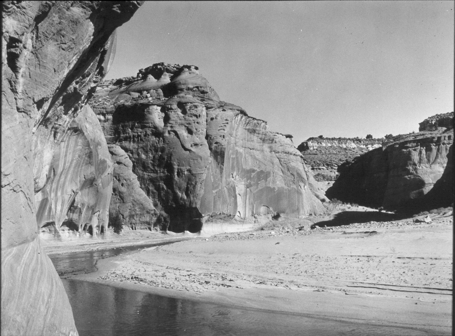
Paria Canyon
1944
2004
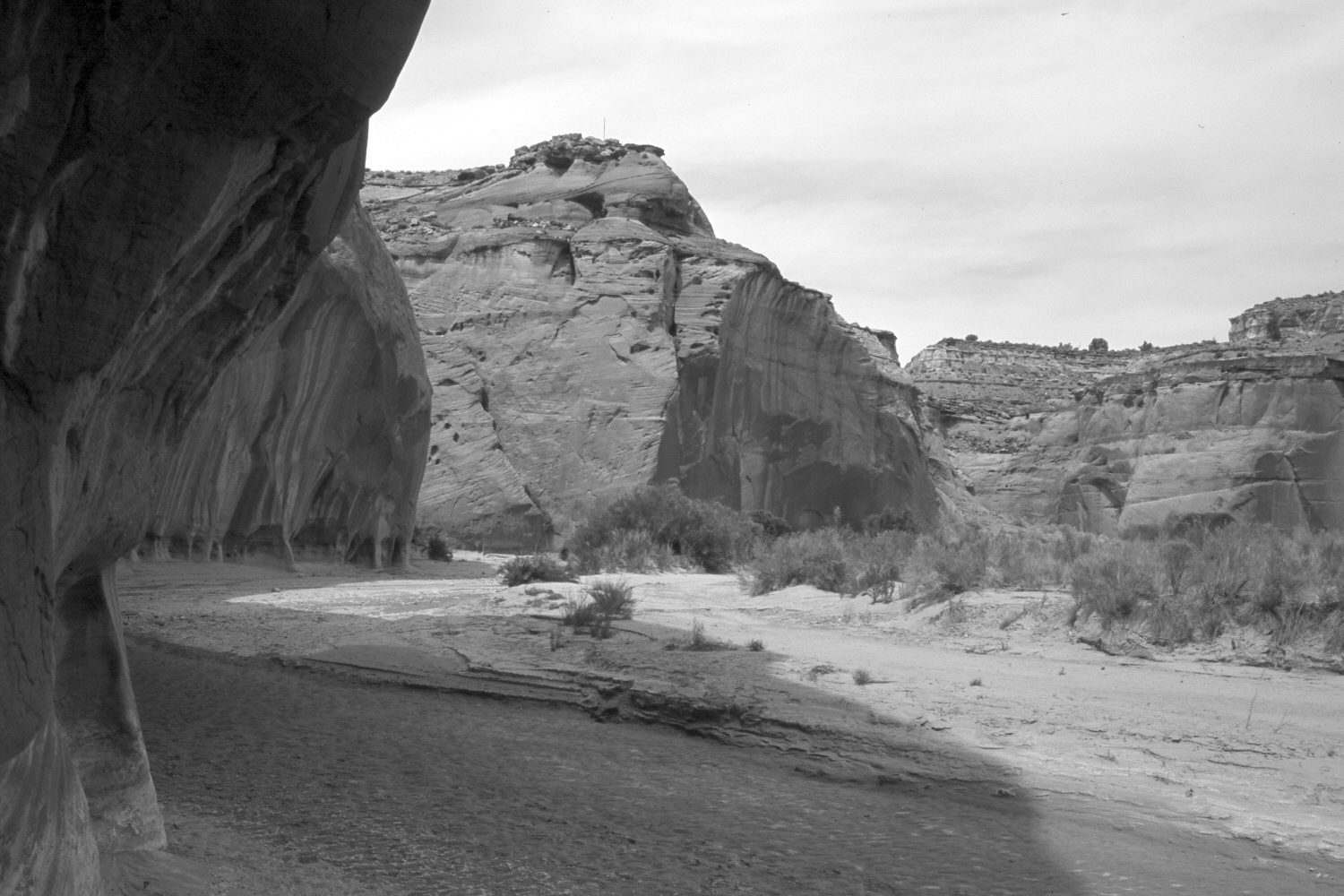
Description:
Plate 455X. Paria Canyon 1944 – 2004 Viewed north up the Paria River. Calf Spring Canyon enters on the left. Tamarisk, arrowwood, sagebrush, rubber rabbitbrush, and Indian rice grass have increased above the active floodplain. The area is fenced to exclude livestock, as it is now officially designated wilderness. Due to the extended drought, the Paria was dry at this point in 2004.
Photo Information:
Original photograph taken by H.E. Gregory (No. 1220a) in 1944; retake by Charles E. Kay on May 16, 2004 - - Photo No. 5315-31. Original photograph held by the U.S. Geological Survey Photographic Library, Denver, CO.
Vegetative Community:
Sagebrush, Riparian
Location:
South West: Section 23, Range 1 West, Township 43 South; UTM 421400 E, 4102100 N; elevation 4,280 ft.
January 2018