Panguitch Lake
1936
2005
Description:
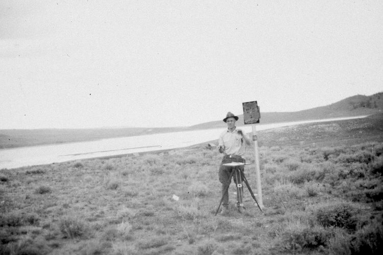
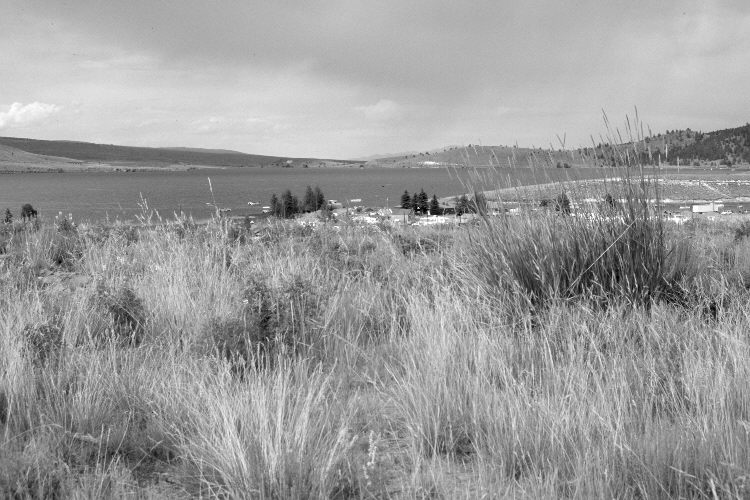
Plate 1028X. Panguitch Lake 1936 – 2005 Viewed northeast at the bend in the old snow course south of Panguitch Lake - - see Plates 1023x and 1027x. In 1936, a series of snow courses were established throughout southern Utah by what is today the Natural Resources Conservation Service (NRCS). When they were first set-up, photographs were taken at each snow survey site. Although the snow course at Panguitch Lake is no longer used by NRCS, the photos remain. A summer home has been built on the original camera station, so the retake was made from the nearest open area on Forest Service land. The buildings in the mid-distance are part of Panguitch Lake Resort. Today, the foreground is mostly needle and thread with some three-tipped sage, lupine, and Great Basin wild rye. Across the lake, juniper, ponderosa pine, and other conifers have increased, while aspen has declined - - see Plate 1017x.
Photo Information:
Original photograph (NRCS – 197) taken on September 9, 1936; retake by Charles E. Kay on August 3, 2005 - - Photo No. 5514-16. Original photograph held by the Snow Survey Supervisor, Natural Resources Conservation Service, Salt Lake City, UT.
Vegetative Community:
Dry Meadow, Conifer, Aspen, Sagebrush
Location:
South West: Section 4, Range 7 West, Township 36 South; UTM 355000 E, 4174300 N; elevation 8,240 ft.