Niotche Creek
1938
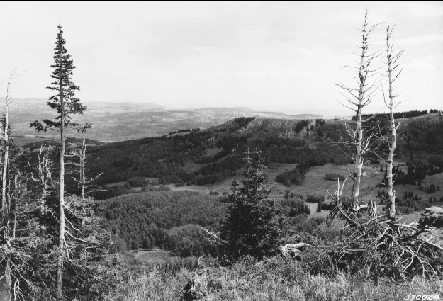
1996
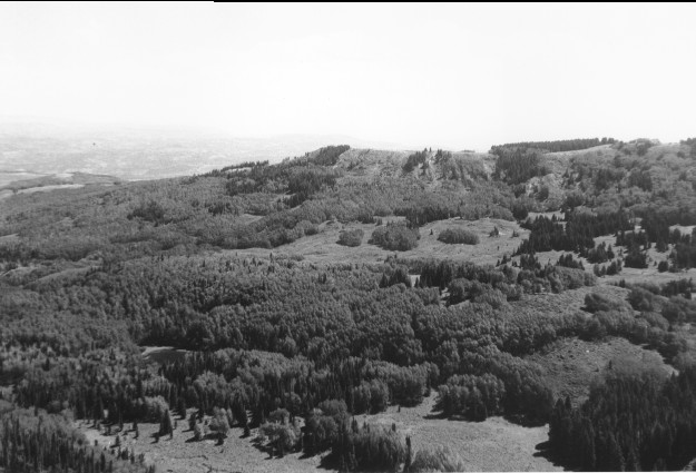
Description:
Plate 18. NIOTCHE CREEK: 1938 - 1996 The 1938 photo point was blocked by conifers 1996; the camera was therefore moved approximately 70 feet east to the edge of a cliff, thus altering the foreground between the two photos. The view is over the upper portion of Niotche Creek. The Gooseberry-Sevenmile road is visible in the 1996 photo. Conifers have increased in height and numbers and have invaded many of the aspen (Populus tremuloides) stands, especially at the uppermost elevations. The aspen have grown taller.
Photo Information:
1938 photo [#370024] taken by the Forest Service; 1996 photo is Kay #4030-19 taken on Aug. 3. Forest Service photo [RG-95-G] is held by the National Archives, Washington, D.C.
Vegetative Community:
Conifer, Aspen
Location:
South Central: Fishlake N.F., Richfield R.D., T24S, R2E., Sect. 2, UTM 4289300 N, 442800 E; elevation 10,530 ft.; view to northeast.