Mule Flat
1959
2003
Description:
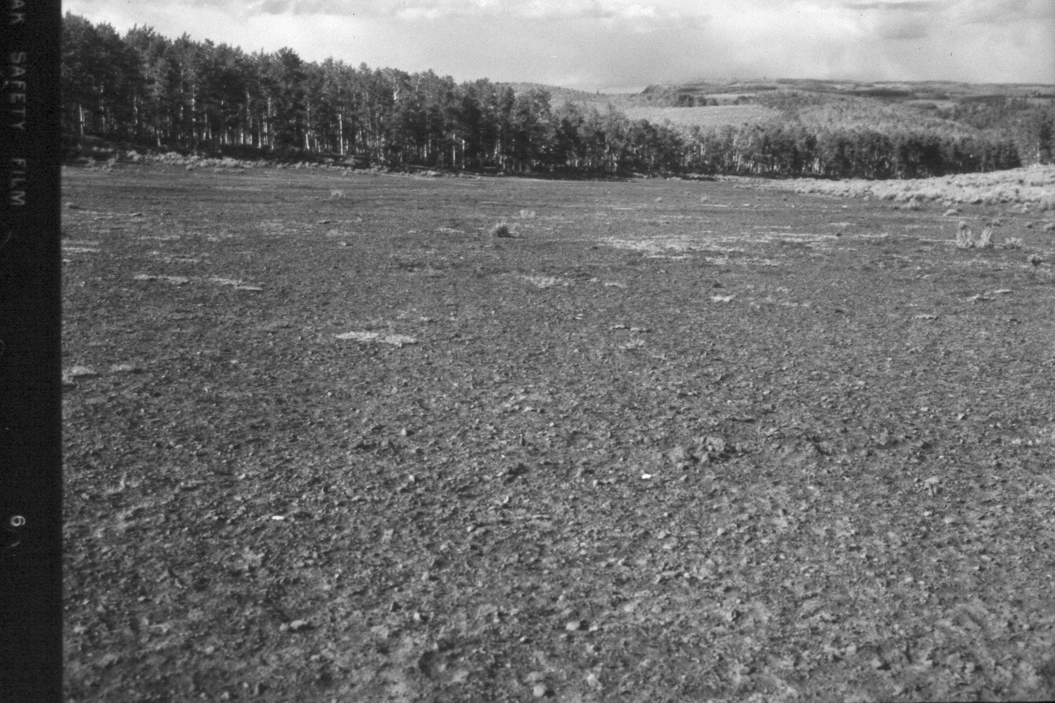
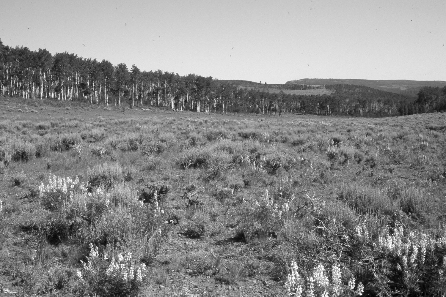
Plate 167X. Mule Flat 1959 - 2003 The Mule Flat Photo Plot Transect was established in 1943 and reread in 1946, 1953, and 1959. Initial range conditions were described as poor and all plant communities were very heavily grazed. Sheet erosion in the meadow was common. All aspen suckers were repeatedly browsed by cattle and deer, as was snowberry. Range conditions had not improved by 1959 (unpublished reports in range files, Panguitch Ranger District, Panguitch, UT). Plate 167x is viewed north to Table Mountain from plot D-258 on the transect centerline. The meadow was very heavily grazed in 1959 but today, grass cover has increased, despite the extended drought. Mountain big sagebrush has also increased. Lupine is visible in the retake. Most aspen stands have not successfully regenerated in many years due to repeated browsing. A few clones, however, were able to successfully produce new stems greater than 6 ft. tall during the 1970’s, when mule deer numbers declined (Kay and Bartos 2000). As vegetative cover in the meadow has increased, soil erosion has declined.
Photo Information:
U.S. Forest Service photograph (unnumbered) by I.H. Johnson on September 16, 1959; retake by Charles E. Kay on July 11, 2003 - - Photo No. 5178-22. Original photographs, negatives, and narrative reports held in the range files on the Panguitch Ranger District, Dixie National Forest, Panguitch, UT.
Vegetative Community:
Aspen, Sagebrush
Location:
South West: Section 24, Range 3 West, Township 31 South; UTM of transect starting point 399050E, 4217000N; elevation 9,620 ft.