Meadow Creek
1944
2000
Description:
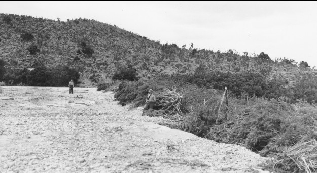
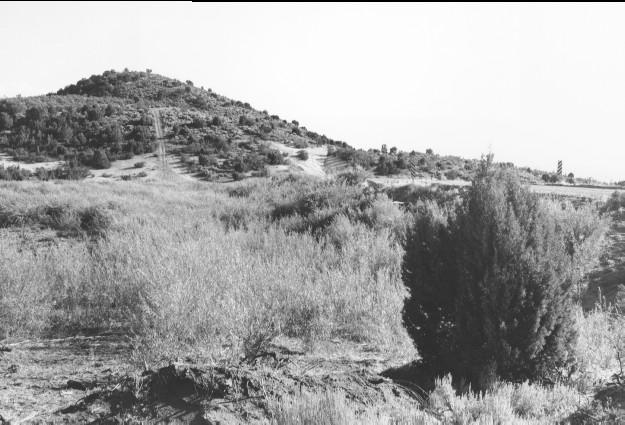
Plate 260. MEADOW CREEK 1944-2000 Viewed southeast across Meadow Creek west of Meadow, Utah. The earlier photograph shows a brush dam that was constructed by local residents to trap debris carried down by floodwaters from the mountains (Plates 121-124). The original camera station could not be reoccupied due to the growth of juniper. Thus, the retake is from a slightly higher elevation. In addition, a new earth-filled dam (photo center left to right) has been built to trap sediment. Pinyon-juniper has increased on the distant hillsides, though, some was probably cut to build the original brush dam. The tall shrub on the near hillside is cliffrose.
Photo Information:
U.S. Forest Service photo (unnumbered) taken in 1944; retake by Charles E. Kay on August 5, 2000 - - Photo No. 4673-2A; Original photo (Watershed Mgt.) held by Fillmore Ranger District, Fishlake National Forest, Fillmore, UT.
Vegetative Community:
Juniper, Pinyon, Mountain Brush
Location:
South Central: Section 18, Range 5 W, Township 22 S; UTM 381700 E, 4305900 N; elevation 5,520 ft.