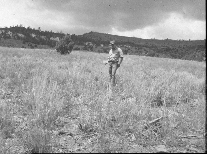
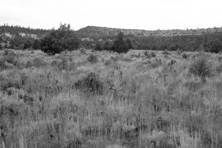
Mammoth Creek
1957
2005
Description:
Plate 991X. Mammoth Creek 1957 – 2005 Viewed northwest along line one of the Parker Three-Step Transect on Mammoth Creek. The 1957 photograph was taken after the area had been root-plowed and reseeded by the Forest Service to improve range conditions. The area is mostly crested and intermediate wheatgrass with some native Stipa spp. The seeding has been invaded by juniper, mountain big sage, bitterbrush, and green rabbitbrush. Ponderosa pine, pinyon, and juniper have increased in the distance.
Photo Information:
U.S. Forest Service photograph (unnumbered) taken on August 28, 1957; retake by Charles E. Kay on August 8, 2005 - - Photo No. 5499-3. Original photographs, negatives, and narrative reports held in the range files on the Cedar City Ranger District, Dixie National Forest, Cedar City, UT.
Vegetative Community:
Dry Meadow, Juniper, Sagebrush, Conifer, Mountain Brush
Location:
South West: Section 4, Range 6 West, Township 37 South; UTM 364750 E, 4164900 N; elevation 7,480 ft.