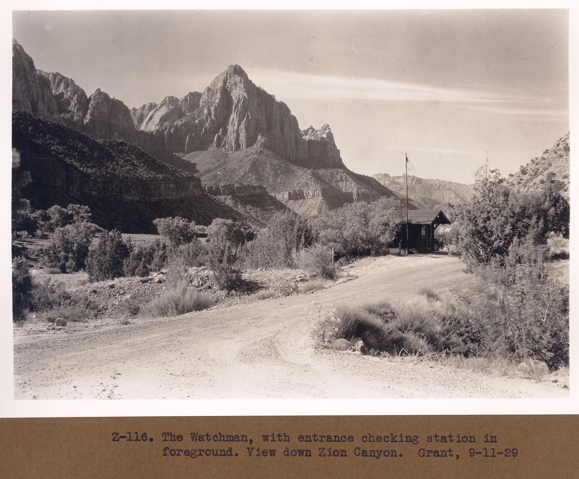
Lower Zion Canyon
1929
2006
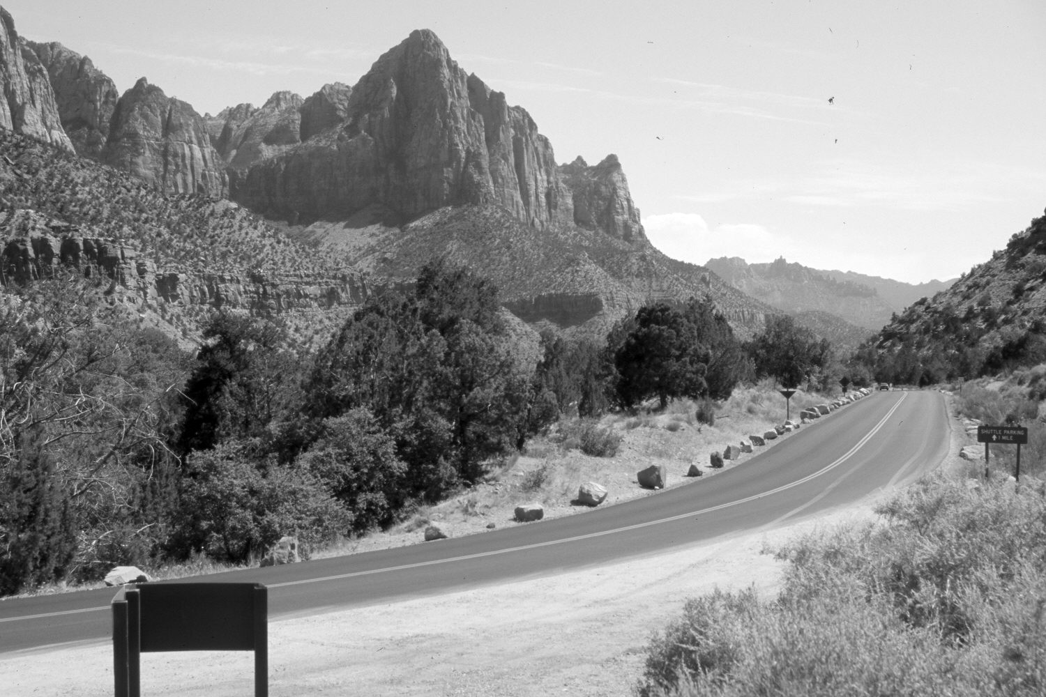
Description:
Plate 1202X. Lower Zion Canyon 1929 – 2006 Viewed south down the Virgin River Valley in Zion National Park. Utah Highway 9 has been widened and paved. The building in the 1929 image is the old entrance station, which was moved further south when the park was enlarged. Pinyon and juniper have increased. The Watchman (6,545 ft) is on the skyline - - photo center.
Photo Information:
Original photograph taken by Grant (Z-116) on September 11, 1929; retake by Charles E. Kay on June 6, 2006 - - Photo No. 5638-17. Original photograph (Zion 12366) held by the National Park Service, Zion National Park, Springdale, UT.
Vegetative Community:
Pinyon, Juniper
Location:
South West: Section 15, Range 10 West, Township 41 South; UTM 324750 E, 4120650 N; elevation 4,048 ft.
January 2018