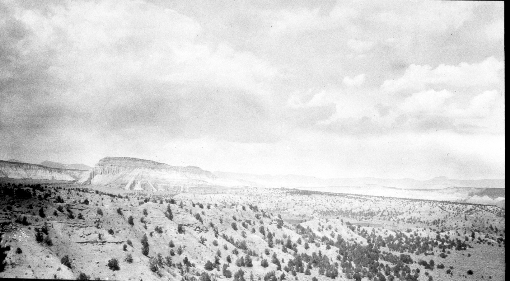
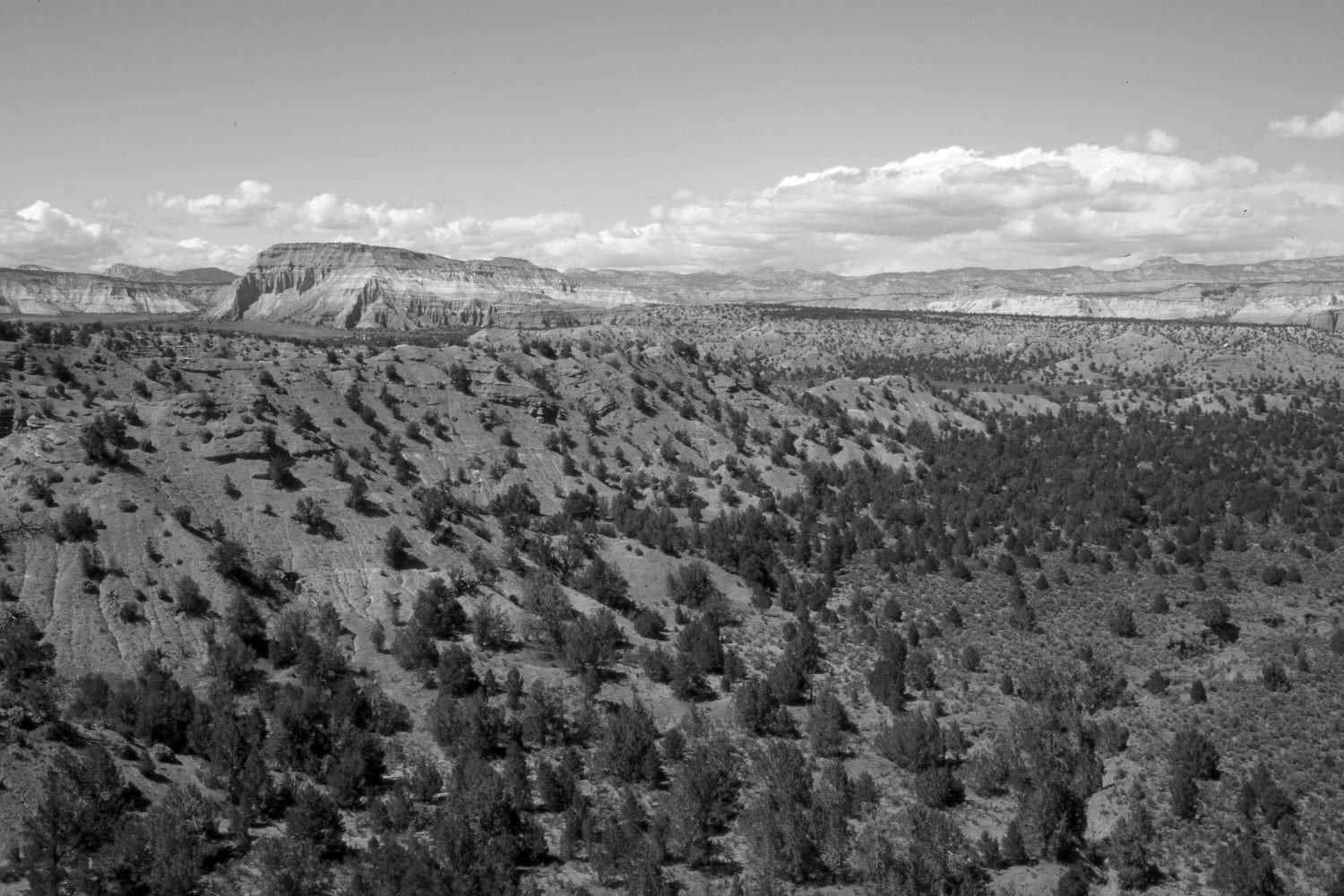
Lower Yellow Creek
1922
2004
Description:
Plate 427X. Lower Yellow Creek 1922 – 2004 Viewed north-northwest over the lower portion of Yellow Creek just above where it enters the Paria River - - see Plate 426x. This photopoint is less than 100 yards west of that for Plate 426x. Pinyon and juniper have increased.
Photo Information:
Original photograph taken by H.E. Gregory (No. 392) in 1922; retake by Charles E. Kay on May 12, 2004 - - Photo No. 5299-20. Original photograph held by the U.S. Geological Survey Photographic Library, Denver, CO.
Vegetative Community:
Pinyon, Juniper
Location:
South West: Section 12, Range 3 West, Township 38 South; UTM 406250 E, 4152750 N; elevation 6,060 ft.
January 2018