Long Valley
1942
2006
Description:
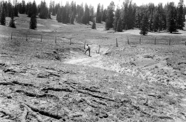
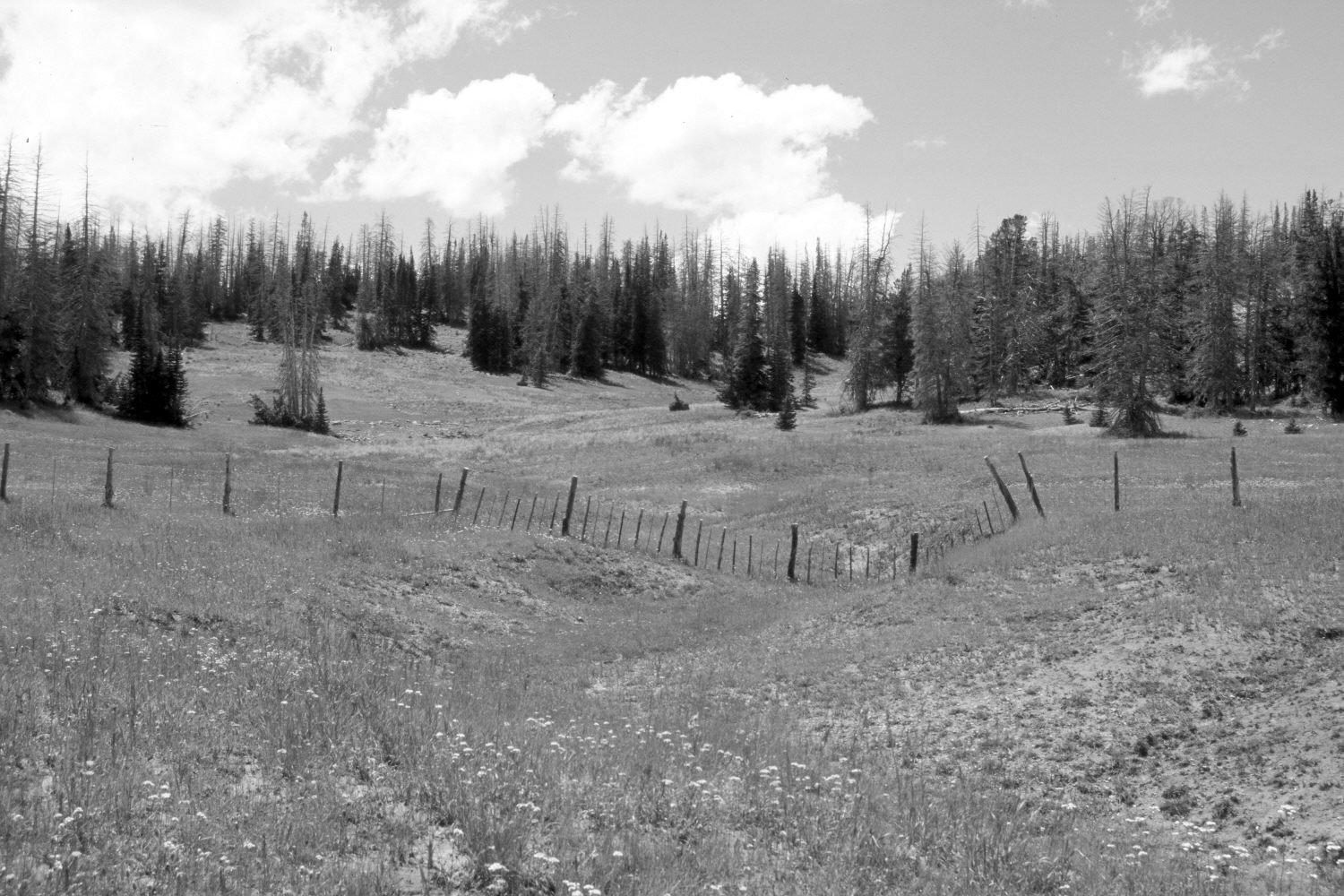
Plate 1366X. Long Valley 1942 – 2006 Viewed west in upper Long Valley. The fence was built in 1936 and is the boundary between Cedar Breaks National Monument and the Dixie National Forest. Thus, at the time the 1942 image was made, the area behind the fence on the National Monument had not been grazed by domestic sheep for six years, while the area between the camera and the fence on the National Forest had continued to be grazed by sheep. In 1960, the Forest Service built a 6.9 acre exclosure at the head of Long Valley that included the area between the camera and the National Monument fence - - see Plates 1096x to 1105x. The exclosure was fenced to exclude only domestic sheep, not deer or elk. The area inside the exclosure was then disced, pitted, and reseeded with smooth brome, Kentucky bluegrass, intermediate wheatgrass, and slender wheatgrass. The Forest Service, however, failed to maintain the exclosure and sheep have grazed the former exclosure since the 1970’s. Conifers have increased, but many of the older spruce were recently killed by insects and disease. Both sides of the fence are more vegetated today than in 1942 and correspondingly soil erosion has declined. The gullies too are more vegetated today than in the past. Native forbs are more abundant on the National Monument where sheep have now been excluded for 70 years. Indian paintbrush, for instance, was observed only on the National Monument side of the fence. Note the pocket gopher castings in the original image - - photo lower left.
Photo Information:
U.S. Forest Service photograph (453913) taken on July 3, 1942; retake by Charles E. Kay on August 3, 2006 - - Photo No. 5705-14. Original photograph held by the Utah Historical Society, Reed W. Bailey Collection (Box 11), Salt Lake City, UT.
Vegetative Community:
Conifer, Dry Meadow
Location:
South West: Section 12, Range 9 West, Township 37 South; UTM 338250 E, 4163800 N; elevation 10,200 ft.