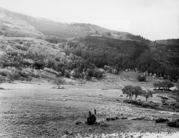
Lone Tree Mountain
1925
2006
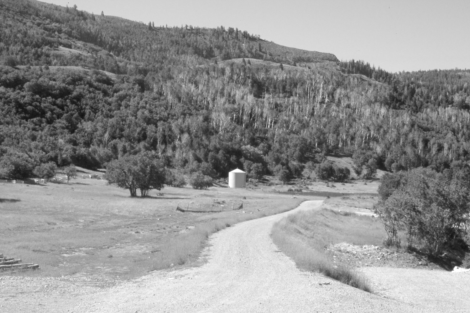
Description:
Plate 1324X. Lone Tree Mountain 1925 – 2006 Viewed south-southeast to Lone Tree Mountain above Cedar City, Utah. Note how heavily grazed the area was in 1925 and how all the oakbrush had been highlined by domestic sheep. The area is now part of an up-scale housing development and the original photopoint has been destroyed by construction. Conifers, pinyon, juniper, and oakbrush have all increased, while aspen has declined. Note the new road cut on the shoulder of Lone Tree Mountain - - photo right-center skyline, which is the photopoint for Plates 1322x, 1323x, 1326x, and 1327x. Plates 1324x and 1325x form a panorama.
Photo Information:
Original photograph taken by W.H. Bradley (No. 113) on June 2, 1925; retake by Charles E. Kay on July 14, 2006 - - Photo No. 5689-10. Original photograph held by the U.S. Geological Survey Photographic Library, Denver, CO.
Vegetative Community:
Conifer, Pinyon, Juniper, Aspen
Location:
South West: Section 36, Range 11 West, Township 36 South; UTM 320400 E, 4167100 N; elevation 8,120 ft.